HOW TO
Add ECW format images to a mosaic dataset in ArcGIS Pro
Summary
An Enhanced Compressed Wavelet or ECW file can be added to a mosaic dataset in ArcGIS Pro. While this is a supported raster format, it is also a non-Esri proprietary format and sometimes the performance is sub-optimal.
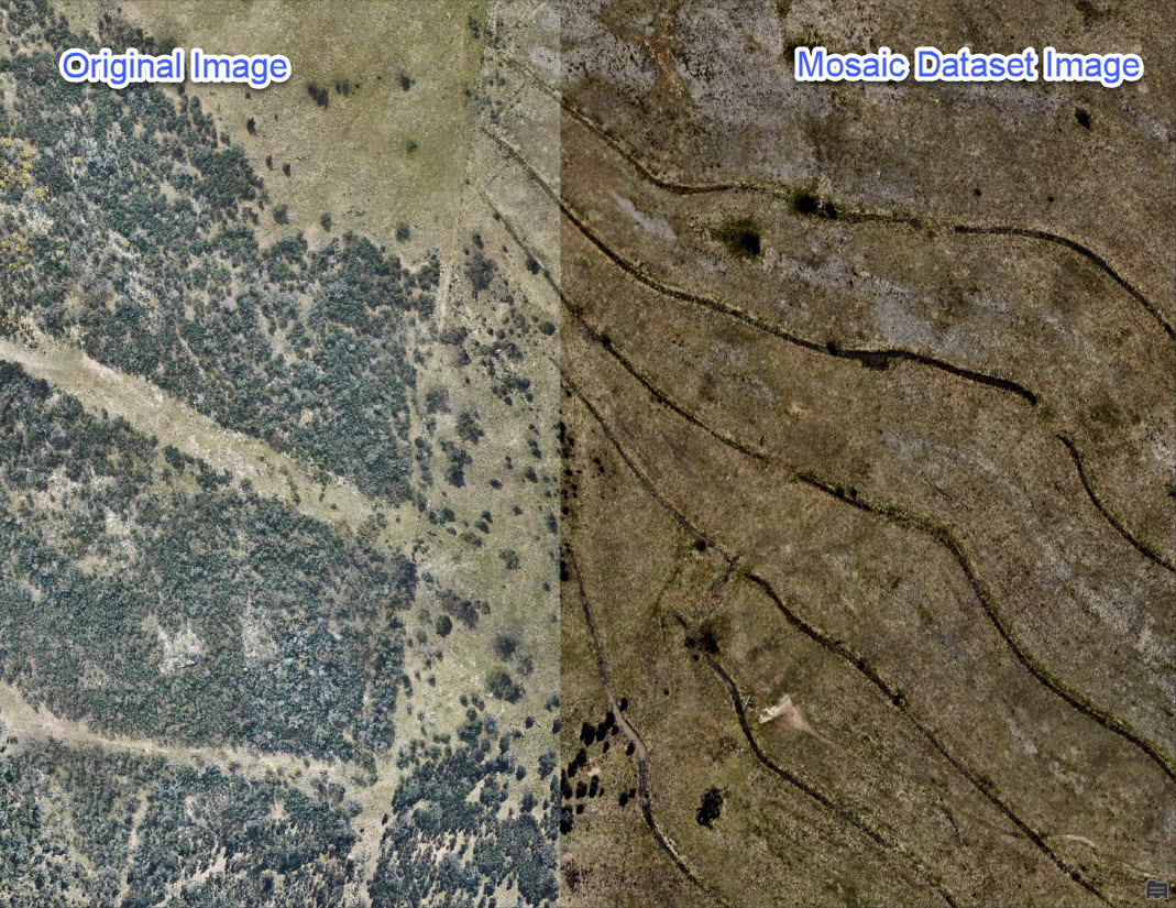
A common workflow to add data to a mosaic dataset is to create an empty mosaic and use the Add Rasters to Mosaic Dataset tool with Update Overviews checked. Overviews are lower-resolution images created to reduce CPU usage and increase display speed. See: Mosaic dataset overviews. However, sometimes when the Overviews option is checked in the geoprocessing parameters, the resulting mosaic can appear darker or lighter than the original imagery, as shown in the following image.
Procedure
To resolve this problem:
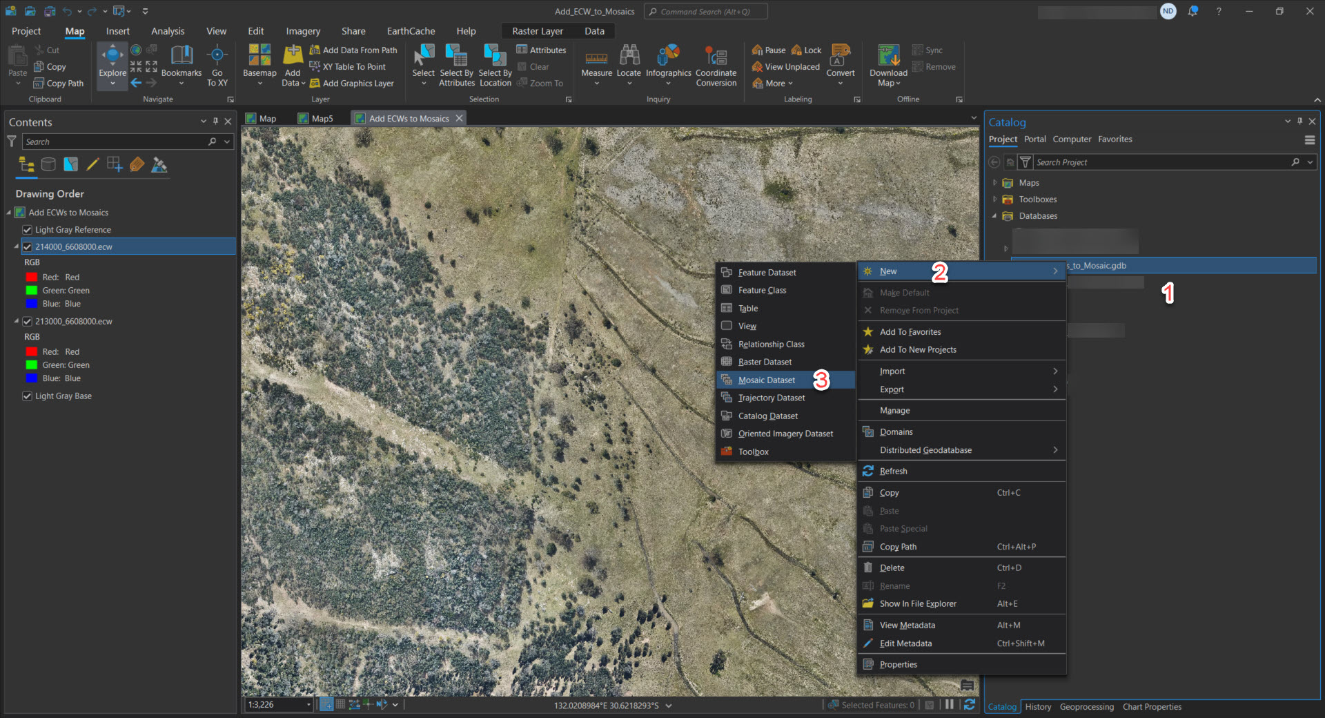
- In the Catalog pane, right-click the geodatabase where the mosaic dataset will be stored.
- Hover or click on New.
- Click Mosaic Dataset.
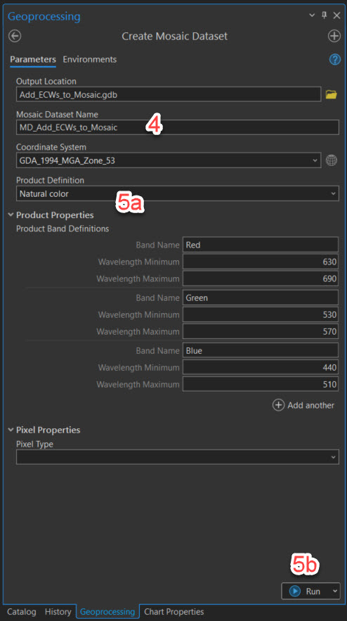
- Enter a Mosaic Dataset Name and confirm the Output Location and Coordinate System.
- Select the relevant Product Definition type. Leave the other settings as default and click Run.
- Go back to the Catalog pane and right-click the new mosaic dataset.
- Click Add Rasters.
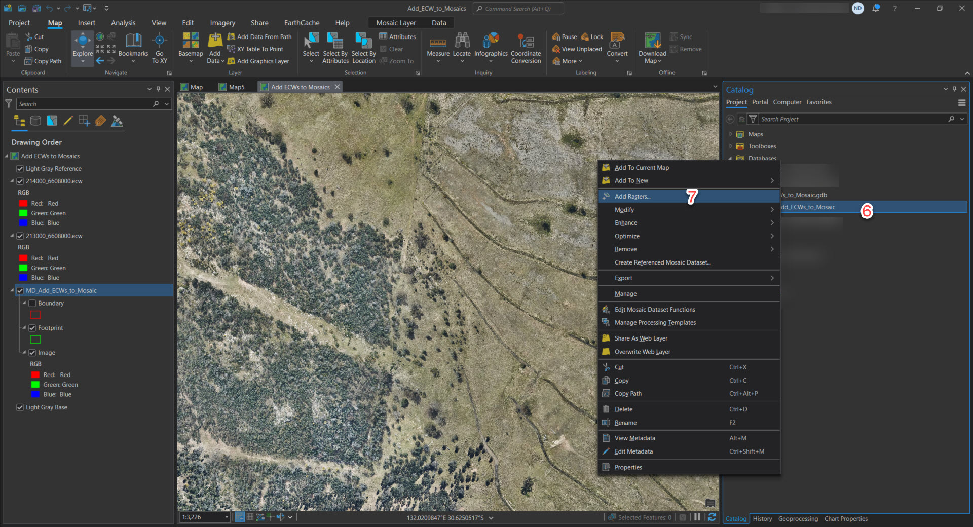
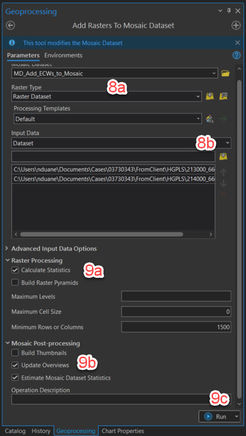
- Confirm that the mosaic dataset is correct and browse for the ECW files to add.
- Check Calculate Statistics and Update Overviews, leave the rest of the parameters as default, and click Run.
- Click the ECW dataset in the Contents pane.
- Click Raster Layer in the context menu.
- Make note of the active stretch types and the gamma value.
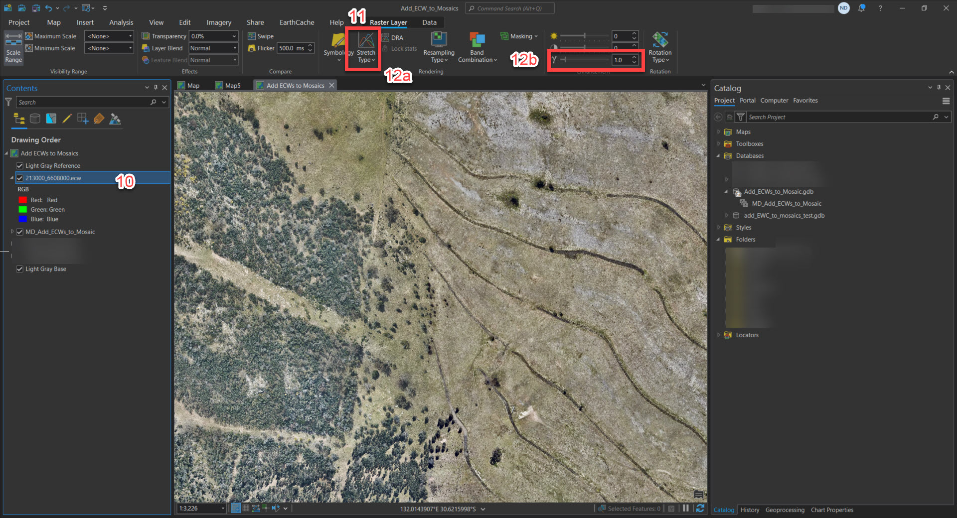
- Click the Mosiac dataset in the Contents pane.
- Click Mosaic Layer in the context menu.
- Adjust the Stretch Type and Gamma value to match the ECW.
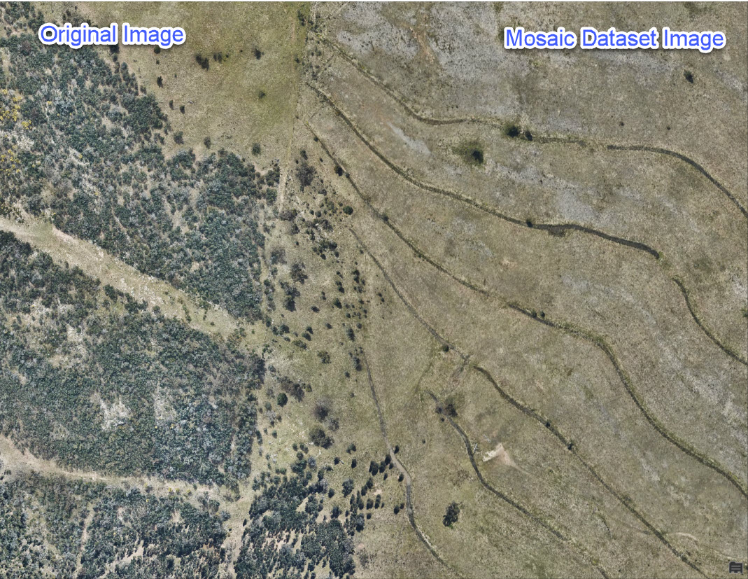
The data in the mosaic dataset should now appear the same as the original, as shown in the image below.
Article ID: 000033920
- ArcGIS Pro
Get support with AI
Resolve your issue quickly with the Esri Support AI Chatbot.


Discover more on this topic
Search for related information
Find training related to this topic
Explore ideas and give feedback
Get help from ArcGIS experts
Start chatting now