HOW TO
Add start and end z-values to a line feature using Python script
Summary
There is no direct way to insert the start and end elevation of a line feature as attribute values. The Interpolate Shape tool can only add z-values to the feature geometry, and the Add Surface Information tool can only add the mean elevation of a feature by defining the elevation surface. However, it is possible to add the start and end z-values to a line feature as attribute values by combining the Interpolate Shape tool and a Python script.
Procedure
The instructions provided describe how to add start and end z-values to a line feature.
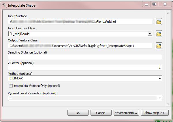
- Run the Interpolate Shape tool to add the z-values vertices to the desired line features. Input the elevation data into the Input Surface field, and select the desired line feature from the Input Feature Class drop-down.
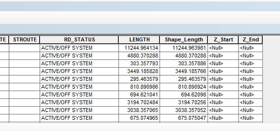
- Open the attribute table of the newly created line feature, and add two new fields with Float or Double data type for the start and end z-values. For more information on adding fields, refer to the following web help document, ArcGIS Desktop: Adding fields.
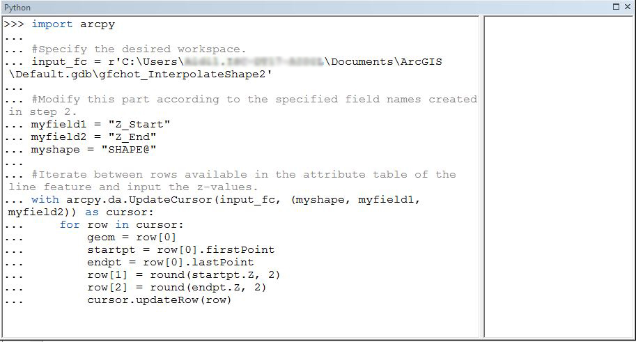
- Run the following script through the Python console (Geoprocessing > Python.)
import arcpy

#Specify the desired workspace.
input_fc = r'<workspace>\<line_feature>'

#Modify this part according to the specified field names created in step 2.
myfield1 = "Z_Start"
myfield2 = "Z_End"
myshape = "SHAPE@"

#Iterate between rows available in the attribute table of the line feature and input the z-values.
with arcpy.da.UpdateCursor(input_fc, (myshape, myfield1, myfield2)) as cursor:
    for row in cursor:
        geom = row[0]
        startpt = row[0].firstPoint
        endpt = row[0].lastPoint
        row[1] = round(startpt.Z, 2)
        row[2] = round(endpt.Z, 2)
        cursor.updateRow(row)
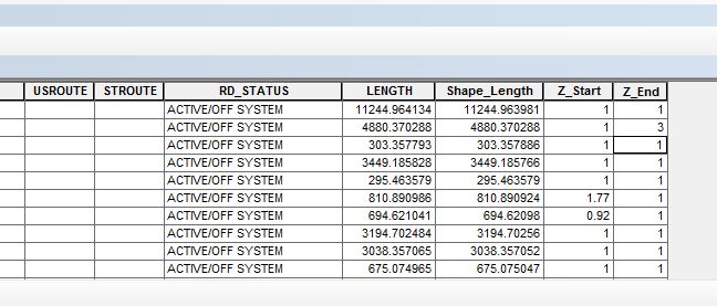
- The result is populated in the two new fields created in Step 2.
Article ID: 000014433
- ArcMap
Get support with AI
Resolve your issue quickly with the Esri Support AI Chatbot.


Related Information
Discover more on this topic
Search for related information
Find training related to this topic
Explore ideas and give feedback
Get help from ArcGIS experts
Start chatting now