HOW TO
Add multiple map extents in ArcGIS Dashboards
Summary
A map extent limits the map area to a region of interest that is a geographic subset of the whole data. Displaying multiple map extents in the same dashboard in ArcGIS Dashboards enables users to compare the attributes of different regions simultaneously. For example, viewing live traffic updates of Manhattan, Staten Island, and Jersey City during rush hour, or comparing crime distributions in large cities.
Procedure
Choose one of the following methods to add multiple map extents in ArcGIS Dashboards:
Configure multiple bookmarks in the same web map and embed in ArcGIS Dashboards
This option is suitable for comparing map extents from the same web map with multiple bookmarks.
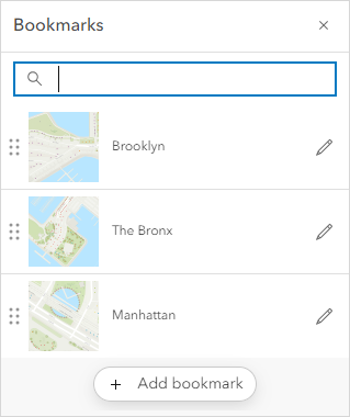
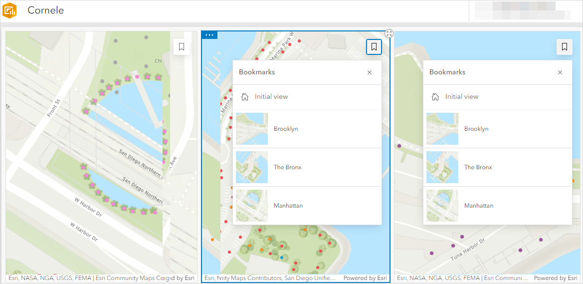
- In ArcGIS Online Map Viewer, create multiple bookmarks that zoom in to different locations of interest in the same web map. For example, the image below shows three bookmarks created for boroughs in New York City: Brooklyn, The Bronx, and Manhattan.
- Save the web map.
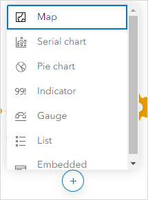
- Open ArcGIS Dashboards and create a dashboard. In the dashboard, click the Add drop-down arrow and select Map.
- Select a map from the map gallery.
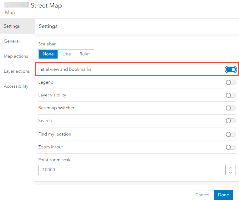
- In the Settings tab, enable the Initial view and bookmarks option. After configuring, click Done.
- Repeat Steps 2 through 5 to embed the web map multiple times, depending on the number of map extents to display. Save the dashboard.
- In each map window, click the Bookmark icon
 at the top right corner, and click the specific bookmark to view the map extent.
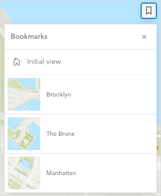
The image below shows the dashboard of three boroughs in New York City configured using bookmarks. Zoom in to view the specific details.
Note:
Although the dashboard is saved before closing, re-opening the dashboard does not preserve the selected bookmarks. The map window shows the default map extent of the embedded web map. Click the bookmarks manually to view each map extent in each map window. It is not possible to automate the process.
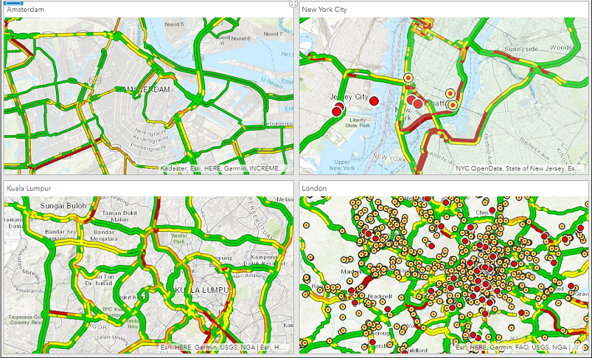
Configure different map extents for multiple web maps and embed in ArcGIS Dashboards
This option is suitable for comparing multiple web maps with different map extents.
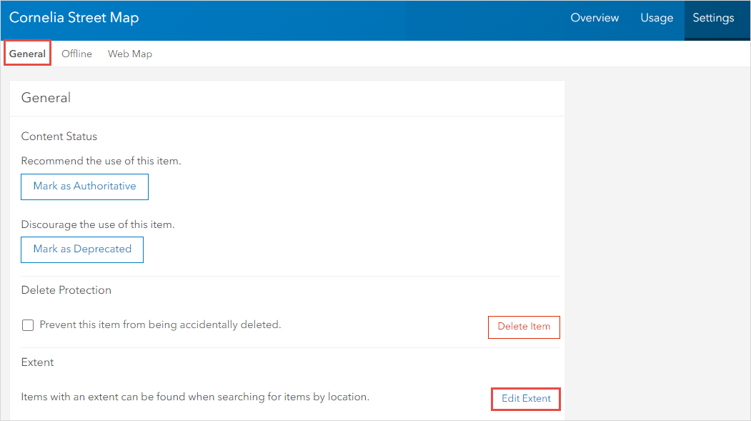
- In ArcGIS Online, open the item details page of the web map. Click Settings.
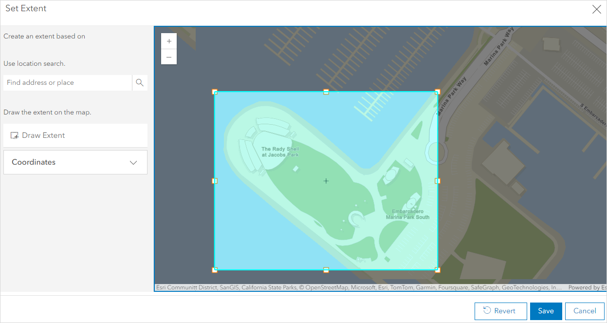
- In the General section, navigate to Extent and click Edit Extent.
- Specify the map extent. Click Save.
- Open ArcGIS Dashboards. Click the Add drop-down arrow and select Map.
- Select a map from the map gallery. After configuring, click Done.
- Repeat Steps 1 through 5 to embed multiple web maps with their respective map extents. Save the dashboard.
Article ID: 000021345
- ArcGIS Online
- ArcGIS Dashboards
Get support with AI
Resolve your issue quickly with the Esri Support AI Chatbot.


Related Information
Discover more on this topic
Search for related information
Find training related to this topic
Explore ideas and give feedback
Get help from ArcGIS experts
Start chatting now