Frequently asked question
How can Esri help those affected by the suspension of NASA WorldWind?
As of May 3, 2019, the NASA WorldWind project has been suspended. This means that the management and development team at the NASA Ames Research Center is no longer actively supporting WorldWind. For more information on the suspension of the WorldWind project, see the NASA WorldWind Project Suspension FAQ
The following FAQs are intended to guide WorldWind developers transitioning to Esri
- How do I transition my WorldWind application to ArcGIS?
You can smoothly transition from WorldWind to Esri, depending on the type of SDK and API you used. Esri has SDKs and a JavaScript API for runtime applications and web development, respectively. These can be accessed at the ArcGIS for Developers website . - What if I just need to add data to a map and get situational awareness?
ArcGIS Online is a hosted cloud offering from Esri that provides a simple experience for adding geographic data to a map. ArcGIS Online enables you to connect people, locations, and data using interactive maps. With ArcGIS Online, you’ll be a part of a very large geospatial community, a community who are creating data and maps every day. Use community data, Esri curated data in the Living Atlas, or publish your own data to create maps, 3D scenes, and applications.
If you need an on-premises solution, ArcGIS Enterprise offers a comparable solution to ArcGIS Online, but hosted on IT infrastructure you control, whether it is local, in the cloud, or a hybrid environment. - What if I need a simple, lightweight, 3D desktop application?
ArcGIS Earth provides a lightweight, easy-to-use interface for an immersive 3D experience with a focused experience for working with geospatial data on the globe. ArcGIS Earth allows an administrator to configure settings to suit the needs of the organization, such as connecting to ArcGIS Enterprise, configuring what layers appear when startup happens, and various other administrative application parameters. There is also the ArcGIS Earth Automation API, which provides a standard interface to communicate with ArcGIS Earth from other applications on the machine. This allows ArcGIS Earth to access resources, control and script ArcGIS Earth behaviors, and integrate with other .NET-supported applications. ArcGIS Earth is available as a desktop application, and for Android and iOS. - What kinds of web applications are created with ArcGIS?
ArcGIS offers different development paradigms to get users up and running with the creation of web applications. The app developer may want to get something up and running very quickly, or create an app that suits all the needs of the customer. The development team may need to decide what is right, getting something deployed quickly with ease, or, spending more time and effort in coding to develop a more detailed application. ArcGIS supports this development spectrum through configuration (less effort), customization (moderate effort), and development (high effort).
With very little configuration, users can deploy a web application using a configurable app. These apps allow users to have a focused experience for interacting with your map, and many of these apps are created by choosing only a few options after the web map is created. It is important to choose the best configurable app to convey the message you want to your end users.
If a configurable app does not suit your needs, Web AppBuilder for ArcGIS is a hosted app development application that allows flexibility in customizing the theme, layout, and widgets. If you need to go a step further and develop custom themes, layouts, and widgets, there is Web AppBuilder for ArcGIS (Developer Edition) .
Finally, if you need to control all aspects of the code in developing the application, the ArcGIS API for JavaScript is a robust API that allows developers to create compelling web applications. - What ArcGIS APIs and SDKs match with WorldWind offerings?
The ArcGIS for Developers website contains SDKs, APIs, sample code, and tutorials to extend the ArcGIS platform and allow developers to create custom applications for their organizations. Users can download SDKs and APIs, sample code, tutorials, and thorough documentation. For those familiar with developing on a specific SDK for WorldWind, here is a rough comparison between WorldWind offerings and ArcGIS offerings.WorldWind ArcGIS Web WorldWind ArcGIS API for JavaScript WorldWind Android ArcGIS Runtime SDK for Android WorldWind Java ArcGIS Runtime SDK for Java
For those working with the WorldWind Server Kit, the ArcGIS platform provides several functionalities. If you need to publish services, you can publish from ArcGIS Online or ArcGIS Enterprise, ArcGIS Pro, ArcMap, or ArcGIS Server. If you are working with a GeoPackage, ArcGIS Pro, ArcMap, ArcGIS Runtime SDK for Android, and ArcGIS Runtime SDK for Java support reading and writing GeoPackages. - How do I start building 3D web applications?
Without any development, you can create applications using configurable templates hosted on ArcGIS Online, or use ArcGIS Enterprise for 'on-premises' implementation. You must have a subscription account, and once that is obtained, you can begin creating web maps and web scenes, and add services and configure your web scene. Once you have saved the web scene, you can create apps from the web scenes following the directions in the Create apps from scenes help document.
If you want to develop 3D web applications from an API, navigate to the Quick Start tutorial for the ArcGIS API for JavaScript. The quick start guide shows how to get an ArcGIS for Developers account, setup a local development environment, or use Esri’s sandbox. The guide also directs you to samples and tutorials. - What are some helpful JavaScript functionalities for Web WorldWind app developers?
The ArcGIS API for JavaScript is a robust API that allows developers to create compelling web applications. Although what was located in the Web WorldWind repository may not match exactly what is in the ArcGIS API for JavaScript, developers may find the following JavaScript resources useful in transitioning their applications.- KML
Add KML layers to applications with the KMLLayer class. Explore a sample in the sandbox. - WMS
Add WMS layers to applications with the WMSLayer class. Explore a sample in the sandbox . - Measurements
Develop functionality to do 3D measurements. This can be accomplished with the DirectLineMeasurement3D class. Explore a sample in the sandbox. - Animation (Time Series)
Develop functionality to examine change over a period of time and visualize this with a color change . This can be accomplished with the ColorVariable and requestAnimationFrame classes. Explore a sample in the sandbox. - Mesh
Develop applications that use mesh geometries. The Low poly terrain using mesh geometry sample shows how to create 3D meshes in applications. - Viewshed
Develop functionality that runs analysis tasks like running a viewshed. The geoprocessing - viewshed example shows how to use the Geoprocessor to calculate a viewshed.
- KML
- Where do I get data for my application?
ArcGIS Online offers many services and much data to add to your application. You can sign up for a public account, or get a subscription account, giving you access to subscription content. You can also access the curated data with rich metadata for your application from the Esri Living Atlas of the World. - Where do I get basemaps for my application?
Different basemaps are available through Esri in a variety of service types. If you need to add a basemap to your application, you can access it via the service REST endpoint:
- Go to the ArcGIS REST Services Directory:
https://services.arcgisonline.com/arcgis/rest/services - Choose the service you want, for example, “World_Topo_Map”.
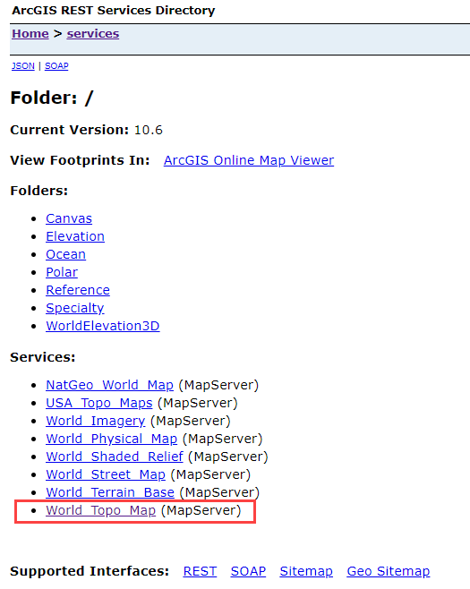
- Select the format of the service to get the URL.
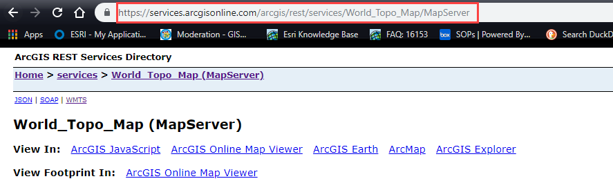
- Copy that URL into your application.
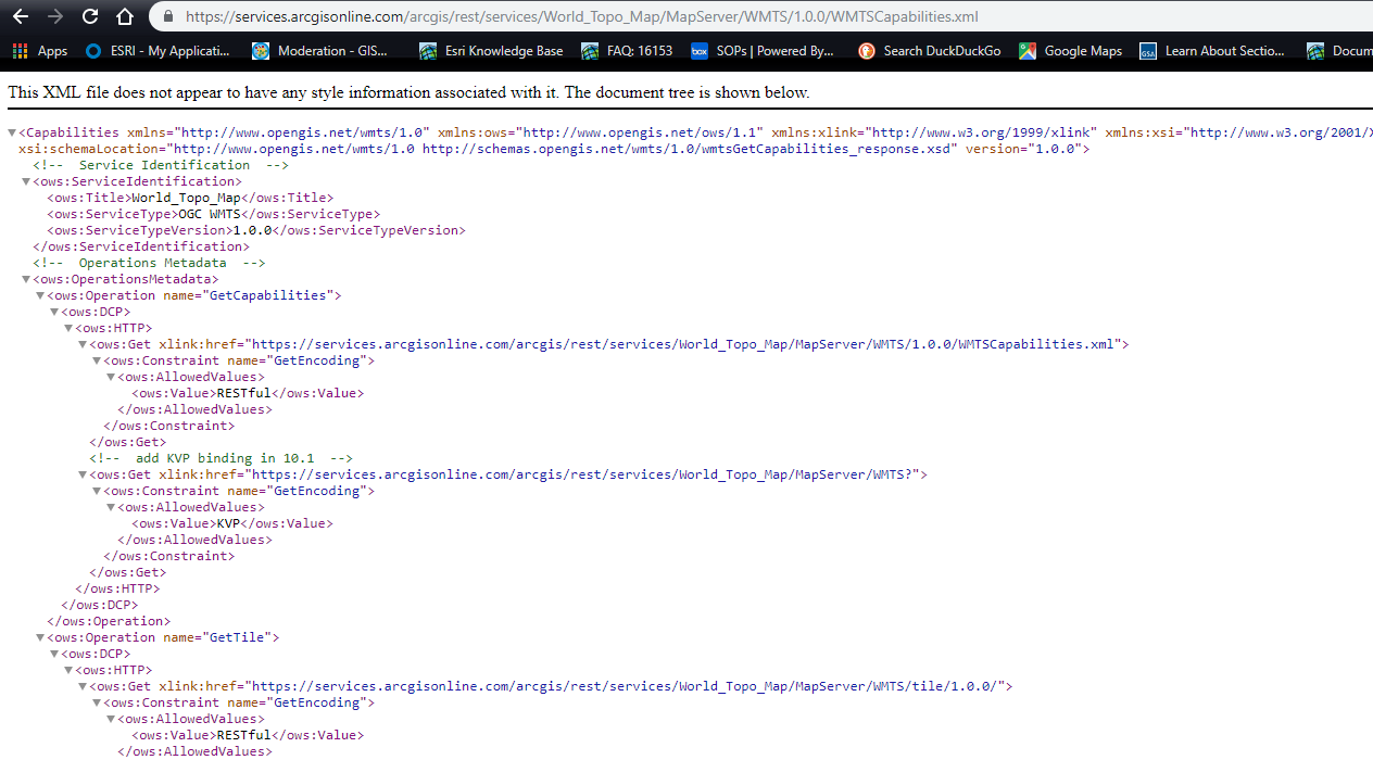
You can copy the REST service directly and add it to an application, or - Choose another service type, such as WMTS, and add that URL to the application.
A complete list of basemaps available with ArcGIS Online is found in the ArcGIS Online Basemaps Group.
WMTS Basemaps
The Web Map Tile Service (WMTS) specification is an international specification for serving digital maps over the web using cached image tiles. Here are a list of basemaps that can be used in your web applications. Basemaps can be found in the ArcGIS Online Basemaps group.
| Name | URL |
|---|---|
| Arctic Imagery | https://services.arcgisonline.com/arcgis/rest/services/Polar/Arctic_Imagery/MapServer/WMTS/1.0.0/WMTSCapabilities.xml |
| Arctic Ocean Base | https://services.arcgisonline.com/arcgis/rest/services/Polar/Arctic_Ocean_Base/MapServer/WMTS/1.0.0/WMTSCapabilities.xml |
| Arctic Ocean Reference | https://services.arcgisonline.com/arcgis/rest/services/Polar/Arctic_Ocean_Reference/MapServer/WMTS/1.0.0/WMTSCapabilities.xml |
| Antarctic Imagery | https://services.arcgisonline.com/arcgis/rest/services/Polar/Antarctic_Imagery/MapServer/WMTS/1.0.0/WMTSCapabilities.xml |
| DeLorme World Base Map | https://services.arcgisonline.com/arcgis/rest/services/Specialty/DeLorme_World_Base_Map/MapServer/WMTS/1.0.0/WMTSCapabilities.xml |
| National Geographic | https://services.arcgisonline.com/arcgis/rest/services/NatGeo_World_Map/MapServer/WMTS/1.0.0/WMTSCapabilities.xml |
| USA Topo Maps | https://services.arcgisonline.com/arcgis/rest/services/USA_Topo_Maps/MapServer/WMTS/1.0.0/WMTSCapabilities.xml |
| World Boundaries and Place Reference | https://services.arcgisonline.com/arcgis/rest/services/Reference/World_Boundaries_and_Places/MapServer/WMTS/1.0.0/WMTSCapabilities.xml |
| World Boundaries and Places Alternate Reference | https://services.arcgisonline.com/arcgis/rest/services/Reference/World_Boundaries_and_Places_Alternate/MapServer/WMTS/1.0.0/WMTSCapabilities.xml |
| World Dark Gray Base | https://services.arcgisonline.com/arcgis/rest/services/Canvas/World_Dark_Gray_Base/MapServer/WMTS/1.0.0/WMTSCapabilities.xml |
| World Dark Gray Base Reference | https://services.arcgisonline.com/arcgis/rest/services/Canvas/World_Dark_Gray_Reference/MapServer/WMTS/1.0.0/WMTSCapabilities.xml |
| World Hillshade | https://services.arcgisonline.com/arcgis/rest/services/Elevation/World_Hillshade/MapServer/WMTS/1.0.0/WMTSCapabilities.xml |
| World Hillshade Dark | https://services.arcgisonline.com/arcgis/rest/services/Elevation/World_Hillshade_Dark/MapServer/WMTS/1.0.0/WMTSCapabilities.xml |
| World Imagery | https://services.arcgisonline.com/arcgis/rest/services/World_Imagery/MapServer/WMTS/1.0.0/WMTSCapabilities.xml |
| World Light Gray Base | https://services.arcgisonline.com/arcgis/rest/services/Canvas/World_Light_Gray_Base/MapServer/WMTS/1.0.0/WMTSCapabilities.xml |
| World Light Gray Base Reference | https://services.arcgisonline.com/arcgis/rest/services/Canvas/World_Light_Gray_Reference/MapServer/WMTS/1.0.0/WMTSCapabilities.xml |
| World Navigation Charts | https://services.arcgisonline.com/arcgis/rest/services/Specialty/World_Navigation_Charts/MapServer/WMTS/1.0.0/WMTSCapabilities.xml |
| World Ocean Base | https://services.arcgisonline.com/arcgis/rest/services/Ocean/World_Ocean_Base/MapServer/WMTS/1.0.0/WMTSCapabilities.xml |
| World Ocean Reference | https://services.arcgisonline.com/arcgis/rest/services/Ocean/World_Ocean_Reference/MapServer/WMTS/1.0.0/WMTSCapabilities.xml |
| World Physical Map | https://services.arcgisonline.com/arcgis/rest/services/World_Physical_Map/MapServer/WMTS/1.0.0/WMTSCapabilities.xml |
| World Reference Overlay | https://services.arcgisonline.com/arcgis/rest/services/Reference/World_Reference_Overlay/MapServer/WMTS/1.0.0/WMTSCapabilities.xml |
| World Shaded Relief | https://services.arcgisonline.com/arcgis/rest/services/World_Shaded_Relief/MapServer/WMTS/1.0.0/WMTSCapabilities.xml |
| World Street Map | https://services.arcgisonline.com/arcgis/rest/services/World_Street_Map/MapServer/WMTS/1.0.0/WMTSCapabilities.xml |
| World Terrain Base | https://services.arcgisonline.com/arcgis/rest/services/World_Terrain_Base/MapServer/WMTS/1.0.0/WMTSCapabilities.xml |
| World Topo Map | https://services.arcgisonline.com/arcgis/rest/services/World_Topo_Map/MapServer/WMTS/1.0.0/WMTSCapabilities.xml |
| World Transportation Reference | https://services.arcgisonline.com/arcgis/rest/services/Reference/World_Transportation/MapServer/WMTS/1.0.0/WMTSCapabilities.xml |
Elevation Services 3D
The table below provides elevation services in WMTS format.
| Name | URL |
|---|---|
| Terrain 3D | https://services.arcgisonline.com/arcgis/rest/services/WorldElevation3D/Terrain3D/ImageServer/WMTS/1.0.0/WMTSCapabilities.xml |
| Topo Bathy 3D | https://services.arcgisonline.com/arcgis/rest/services/WorldElevation3D/TopoBathy3D/ImageServer/WMTS/1.0.0/WMTSCapabilities.xml |
Scientific Data REST End Points
Current WorldWInd users in the meteorology field may find these following web services useful for their applications. There are other real-time feeds available in ArcGIS Online through the Living Atlas.
| Name | URL |
|---|---|
| Near-Real-Time Surface In-Situ Observations | https://nowcoast.noaa.gov/arcgis/rest/services/nowcoast/obs_meteocean_insitu_sfc_time/MapServer |
| Recent Satellite Emulated Lightning Strike Density Imagery | https://nowcoast.noaa.gov/arcgis/rest/services/nowcoast/sat_meteo_emulated_imagery_lightningstrikedensity_goes_time/MapServer |
| Geostationary Weather Satellite Imagery | https://nowcoast.noaa.gov/arcgis/rest/services/nowcoast/sat_meteo_imagery_time/MapServer |
| Weather Radar Imagery | https://nowcoast.noaa.gov/arcgis/rest/services/nowcoast/radar_meteo_imagery_nexrad_time/MapServer |
| Surface Meteorological and Hydrologic Analyses | https://nowcoast.noaa.gov/arcgis/rest/services/nowcoast/analysis_meteohydro_sfc_rtma_time/MapServer |
| NWS Multi-Radar Multi-Sensor (MRMS) quantitative precipitation | https://nowcoast.noaa.gov/arcgis/rest/services/nowcoast/analysis_meteohydro_sfc_qpe_time/MapServer |
| Short-Duration Hazards (e.g. Severe Thunderstorms/Tornadoes/Flash Floods) Watches | https://nowcoast.noaa.gov/arcgis/rest/services/nowcoast/wwa_meteoceanhydro_shortduration_hazards_watches_time/MapServer |
| Warnings | https://nowcoast.noaa.gov/arcgis/rest/services/nowcoast/wwa_meteoceanhydro_shortduration_hazards_warnings_time/MapServer |
| Radar base reflectivity | https://idpgis.ncep.noaa.gov/arcgis/rest/services/radar |
Article ID: 000021168
- ArcGIS Runtime SDK for Android
- ArcGIS Runtime SDK for Java
- ArcGIS API for JavaScript
- ArcGIS Online
Get support with AI
Resolve your issue quickly with the Esri Support AI Chatbot.


Discover more on this topic
Search for related information
Find training related to this topic
Explore ideas and give feedback
Get help from ArcGIS experts
Start chatting now