PROBLEM
Geospatial enabled PDF export may result in incorrect coordinates and measurements in Adobe Acrobat
Description
Sometimes when users export a geospatially enabled PDF from ArcGIS Pro, they see incorrect coordinates and measurements in Adobe Acrobat.
Cause
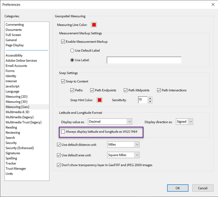
This is caused by a setting in Adobe Acrobat called “Always display latitude and longitude as WGS 1984”. This is enabled by default in Acrobat and forces the PDF into WGS 1984, which can cause incorrect coordinates or measurements if the PDF was explored with a different datum.
Solution or Workaround
To correct this, uncheck the Always display latitude and longitude as WGS 1984 option as follows:
- Navigate to the 'burger' menu at the top left-hand corner of Adobe Acrobat,
- Select Preferences, and open the Measuring (Geo) page, as shown in the image below.
- Uncheck Always display latitude and longitude as WGS 1984, and click OK.
After unchecking this option, the PDF will be displayed in its correct datum, chosen upon export.
Article ID: 000032005
- ArcGIS Pro
Get support with AI
Resolve your issue quickly with the Esri Support AI Chatbot.


Related Information
Discover more on this topic
Search for related information
Find training related to this topic
Explore ideas and give feedback
Get help from ArcGIS experts
Start chatting now