HOW TO
Find a location in a defined coordinate system in Portal for ArcGIS
Summary
Finding a place on a map based on coordinates in a specific spatial reference can be done using the Location tool in the Map Viewer, which is included in both ArcGIS Online, and ArcGIS Enterprise 10.8.1 or higher. This tool is designed for both online and offline use, providing flexibility in different operational environments. Notably, this method does not require geocoding services. The tool can locate a point based on coordinates in the coordinate system of the basemap. Below is a step-by-step guide through this process.
Prerequisites
If ArcGIS Online, is used, the Prerequisites section can be skipped. To access and utilize the new Map Viewer in Portal for ArcGIS, the following requirements must be ensured.
When using ArcGIS Enterprise 10.8.1 or 10.9, Map Viewer Beta must be installed. These versions require the installation of the Map Viewer Beta separately, as it is not included by default in the base installation of these ArcGIS Enterprise versions. Refer to the following links for steps regarding installation.
Procedure
- Access the Map Viewer.
- Log in to the Portal for ArcGIS or ArcGIS Online.
- From the Home page, click the Map page to access the tool.
- In Map Viewer, configure a custom basemap in a certain coordinate system that represents a spatial reference for layers you published.
- Click Basemap on the Contents (dark) toolbar.
- Click Current basemap and add your layers from the bottom of the pane.
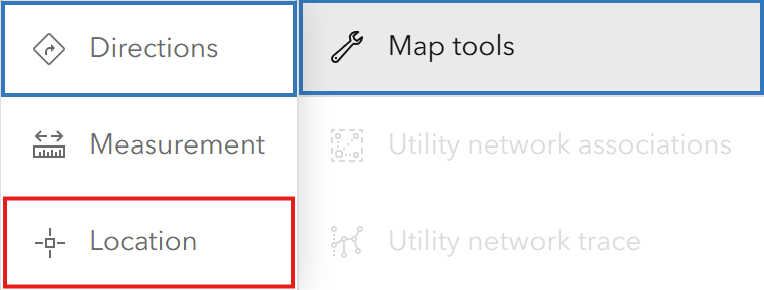
- Open the Location tool.
- On the Settings (light) toolbar, click on Map tools
 .
. - Choose Location.
- On the Settings (light) toolbar, click on Map tools
- Click the Expand
 control on the right side to display options.
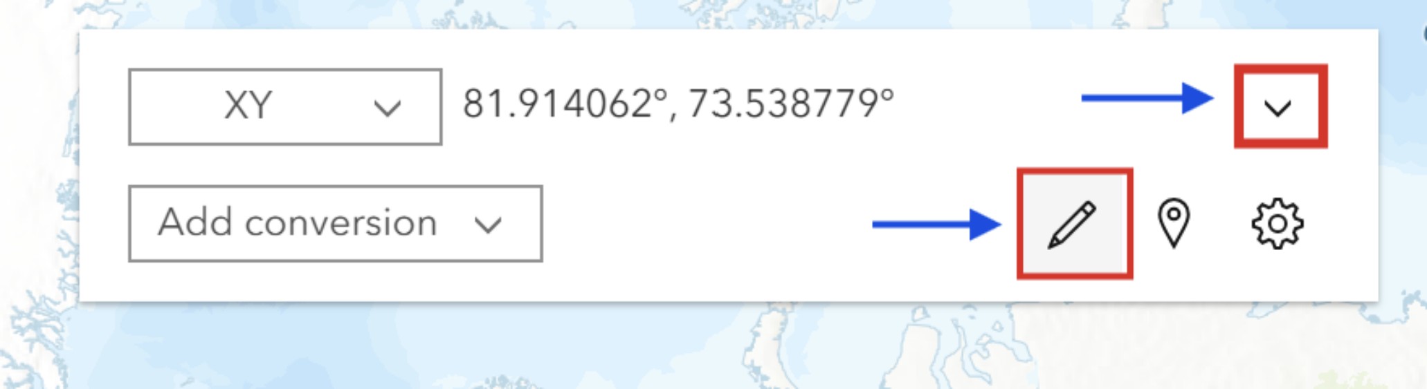
- Click the Input coordinate
 (pencil icon) to provide the coordinates.
- In the Input coordinate window, select BASEMAP to use the coordinate system of the current basemap.
- In the Input coordinate box, type the coordinate values. For example, 790354.917, 306958.376 in Pulkovo 1942(58) / Stereo70, the coordinate system of the basemap used for this article. To ensure better precision, include more significant digits after the decimal point.
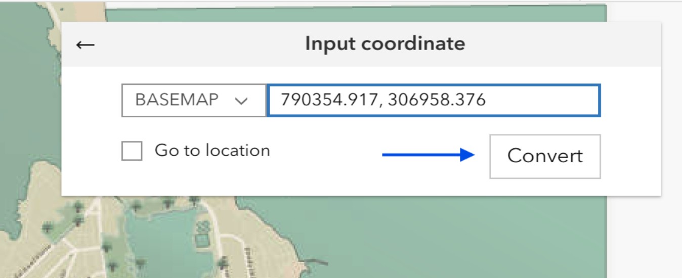
- Click Convert to locate the point.
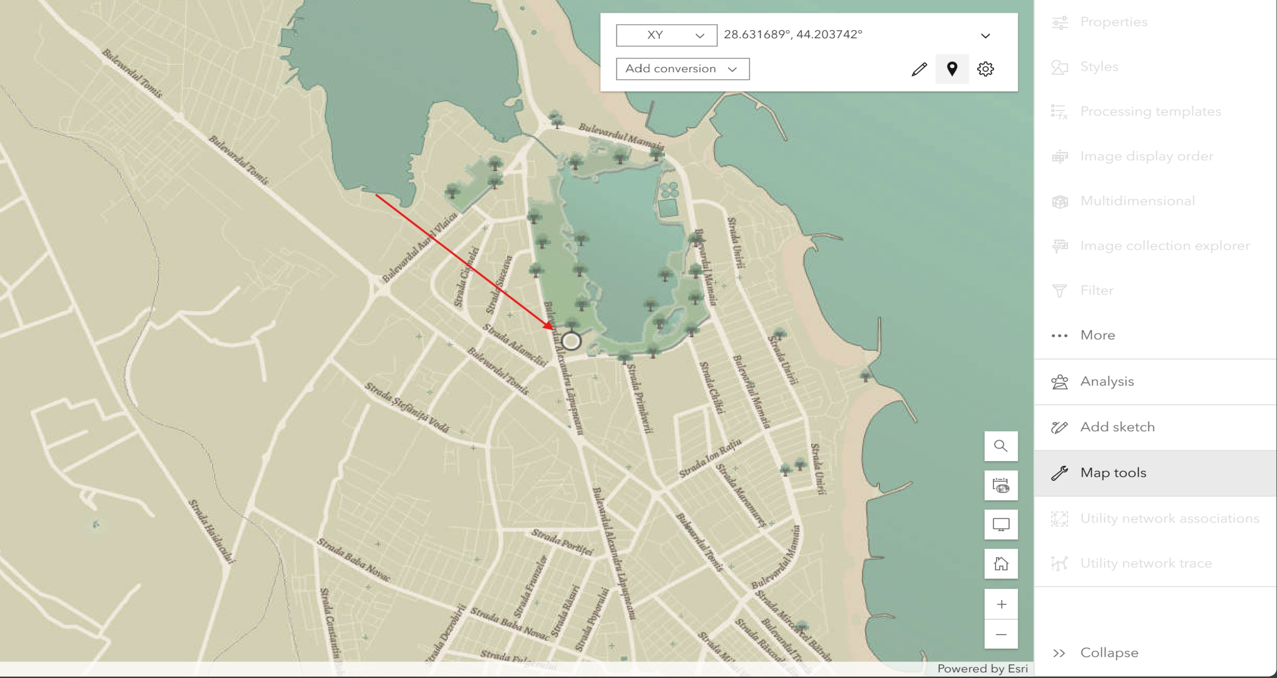
After converting the coordinates, the tool places a small circle on the resulting location on the map, as shown in the image below.
Article ID: 000033360
- ArcGIS Online
- Portal for ArcGIS
Get support with AI
Resolve your issue quickly with the Esri Support AI Chatbot.


Related Information
Discover more on this topic
Search for related information
Find training related to this topic
Explore ideas and give feedback
Get help from ArcGIS experts
Start chatting now