Frequently asked question
How do I create contour lines in Site Scan Manager for ArcGIS ?
Site Scan Manager enables the user to create contour files representing elevation, without the need for third-party software. These files can be exported in .dxf or .shp format.
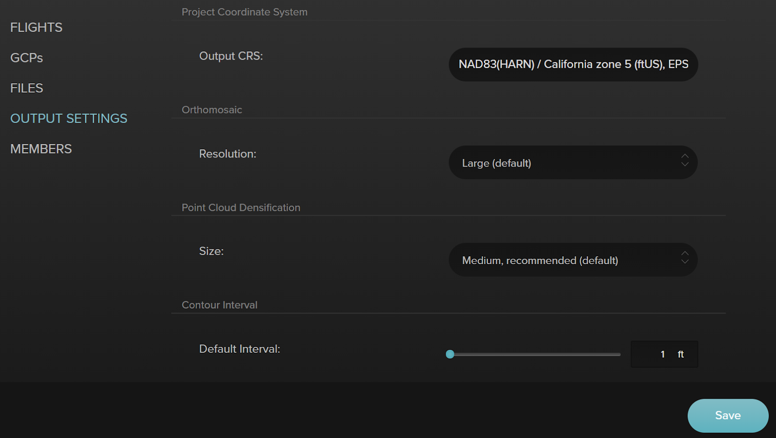
Contour files are automatically generated after the flight is processed, and Site Scan uses the DTM (Digital Terrain Model) to create these lines. To ensure the contour files are generated to desired intervals, modify the default value in the project’s Output Settings, as follows:
- Click the Project tab, and select the project.
- On the Project view, click Output Settings.
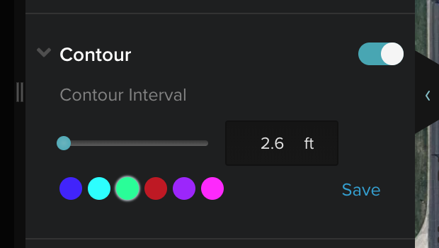
The interval value can also be modified directly, after the files are created, on the flight’s 2D view.
- Click the Save button after modifying the settings. The new files take a few minutes to generate.
Article ID: 000022988
- Site Scan Manager for ArcGIS
Get support with AI
Resolve your issue quickly with the Esri Support AI Chatbot.


Discover more on this topic
Search for related information
Find training related to this topic
Explore ideas and give feedback
Get help from ArcGIS experts
Start chatting now