Frequently asked question
Is it possible to convert GIS data to CAD data in ArcGIS Pro
Yes, it is possible to convert GIS data to CAD data in ArcGIS Pro. Computer-aided design (CAD) is a hardware and software technology used by designers to create and document real-world objects. Two frequently used general-purpose CAD systems are AutoCAD and MicroStation. These systems work with a variety of applications. The process of geographically modifying a CAD drawing without changing the original source data is known as georeferencing. This is accomplished in ArcGIS Pro by connecting points in the CAD drawing to known geographic coordinates. Once a CAD dataset is georeferenced, it is converted in memory while the original data stays intact on disk.
The workflow below describes how to convert GIS data to CAD data in ArcGIS Pro.
- Start ArcGIS Pro and open the project.
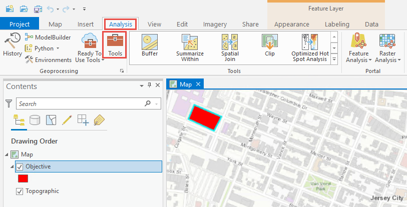
- In the ArcGIS Pro ribbon, click Analysis > Tools to open the Geoprocessing pane.
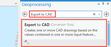
- In the Geoprocessing pane, search for Export to CAD in the search bar, and click Export to CAD (Conversion Tools).
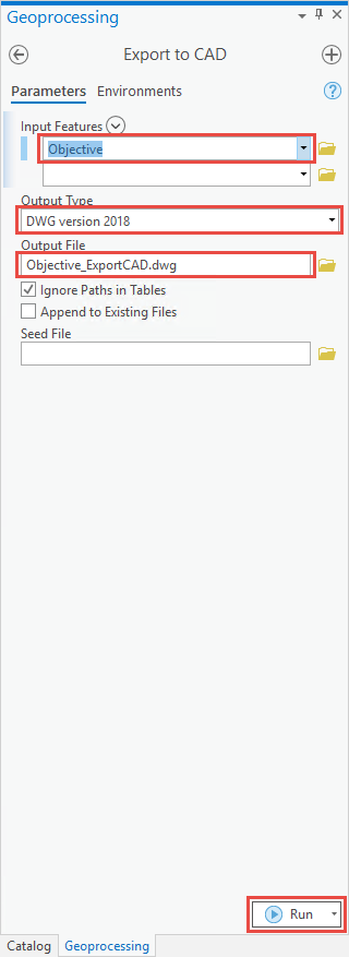
- In the Export to CAD pane, configure the following parameters.
- For Input Features, select the feature layer.
- For Output Type, select the output file's CAD platform and file version.
- For Output File, specify the output CAD drawing file's path.
Note:
Refer to ArcGIS Pro: Export to CAD (Conversion) for further information on the parameters in the Export to CAD pane.
- Click Run.
Article ID: 000026360
- ArcGIS Pro 2 8 x
- ArcGIS Pro 2 7 x
- ArcGIS Pro 2 x
Get support with AI
Resolve your issue quickly with the Esri Support AI Chatbot.


Related Information
Discover more on this topic
Search for related information
Find training related to this topic
Explore ideas and give feedback
Get help from ArcGIS experts
Start chatting now