Frequently asked question
Can buffers around point features be created in ArcGIS Field Maps?
No, it is not possible to create buffers around point features when collecting data using the ArcGIS Field Maps mobile app. ArcGIS Field Maps currently does not offer the capability to create buffers or lines surrounding the collected point features in real time. Alternatively, buffers can be created around the point features after the data is collected in ArcGIS Field Maps Designer. Follow the following workaround to create a buffer around the point features.
- Open ArcGIS Field Maps Designer from the app launcher in ArcGIS Online.
- On the Map page, click the map card.
- On the Forms page, click Geofences > Add geofence.
- Configure the buffer layer.
- In the New geofence pane, in the Name text box, specify a name for the buffer layer.
- In the Action section, under Layer, select the layer from the Layers drop-down menu.
- Under Buffer, enter a buffer value in the Buffer text box.
- Under Units, select the unit from the Units drop-down menu.
- In the Action section, under Message, specify a text message in the Message text box.
- Click Save.
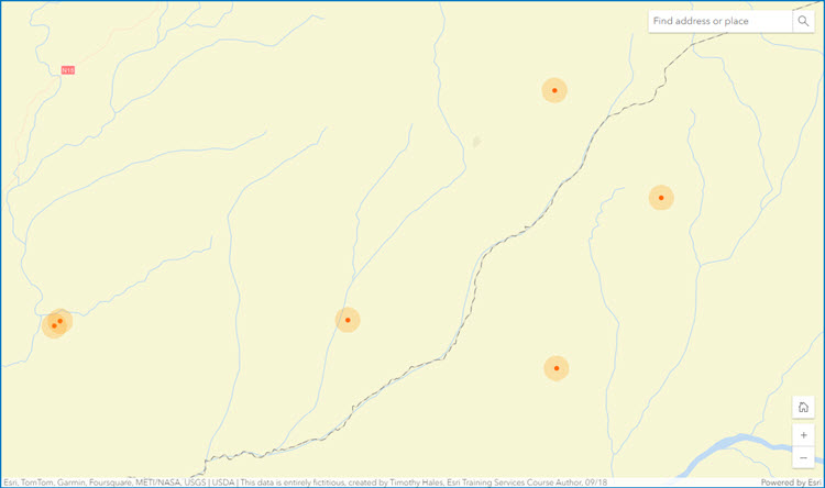
The image below shows the buffers created around the point features in ArcGIS Field Maps Designer.
Buffers can also be created around the point features after the data is collected in ArcGIS Online Map Viewer. Refer to ArcGIS Online: Create Buffers (Map Viewer) for more information.
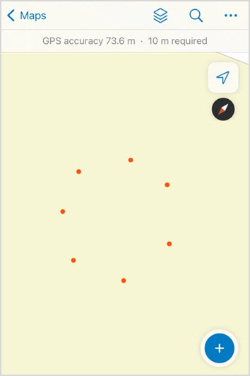
Another option is to collect the data points around the desired location of the point feature at a distance to emulate a buffer. However, this task may be time-consuming if the point features are collected at a larger distance. This is shown in the image below as an example.
Article ID: 000032407
- ArcGIS Field Maps Android
- ArcGIS Field Maps iOS
Get support with AI
Resolve your issue quickly with the Esri Support AI Chatbot.


Related Information
Discover more on this topic
Search for related information
Find training related to this topic
Explore ideas and give feedback
Get help from ArcGIS experts
Start chatting now