Frequently asked question
Can ArcGIS Survey123 surveys with reverse geocoding using the ArcGIS World Geocoder be accessible to public users?
Reverse geocoding using the ArcGIS World Geocoder consumes credits and requires users to sign in to an ArcGIS Online organizational account. However, it is possible for ArcGIS Survey123 surveys with reverse geocoding using the ArcGIS World Geocoder to be accessible to public users.
Use a different locator service
In ArcGIS Survey123 Connect, specify the URL to a custom locator as a parameter in the calculation column in the XLSForm using the following format:
pulldata("@geopoint",${location},"reversegeocode.address.Match_addr","https://yourlocatorservice/GeocodeServer")
Add the ArcGIS World Geocoder to the ArcGIS Online content
Note:
The following workflow makes the reverse geocoding available to public users, however, the credits consumed are charged against the author’s ArcGIS Online service credits. To limit the usage of the author’s locator service, apply a rate limit or add a referrer URL or IP.
Refer to How To: Limit access to secured hosted services in ArcGIS Online for public-facing web applications for more information.
- Log in to the ArcGIS Online organizational account.
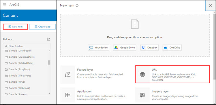
- Click Content > My Content.
- Click + New item, and select URL, as shown in the next image:
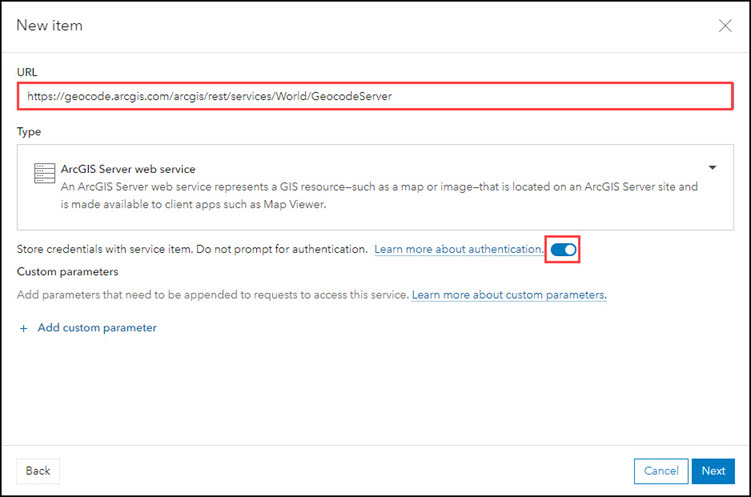
- In the New item window, paste the following URL to ArcGIS World Geocoder in the URL box and make sure that the ArcGIS Server web service is selected for Type.
https://geocode.arcgis.com/arcgis/rest/services/World/GeocodeServer
- In the New item dialog shown below, toggle on the switch to enable the Store credentials with service item. Do not prompt for authentication option and click Next.
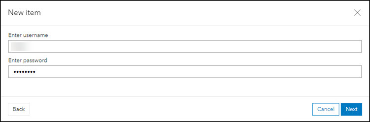
- Add a username in the Enter username box, and password in the Enter password box with the credentials for an ArcGIS Online organizational account with geocoding privileges (both username and password are case-sensitive).
- Click Next.
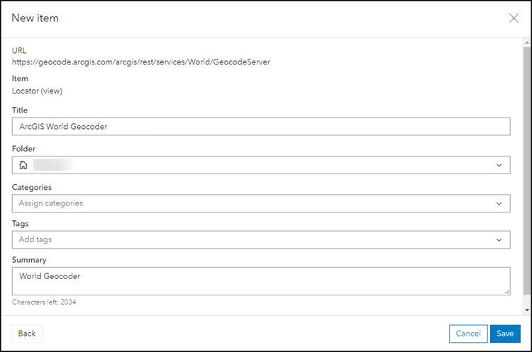
- Give the item a title and click Save. A new locator is added.
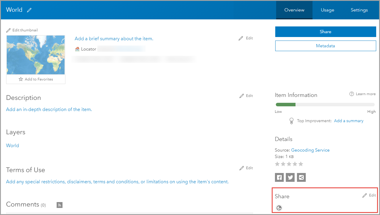
- On the Overview tab of the locator's item details page, share the locator to the public. On the Settings tab, set the Limit Usage configurations if needed (for instance, to make your locator accessible only through your survey form. Refer to ArcGIS Online: Limit usage of secure services for more information).
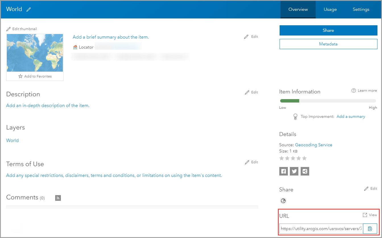
- Copy the URL of the locator, and paste the link in the calculation column in the XLSForm using the following format:
pulldata("@geopoint",${location},"reversegeocode.address.Match_addr","https:// ")

- Save the changes, and publish the survey.
Article ID: 000025328
- ArcGIS Online
- ArcGIS Survey123 Connect
Get support with AI
Resolve your issue quickly with the Esri Support AI Chatbot.


Related Information
Discover more on this topic
Search for related information
Find training related to this topic
Explore ideas and give feedback
Get help from ArcGIS experts
Start chatting now