PROBLEM
Discrepancy in the geolocation of an IFC file (ifc2x3 or ifc4x) created by exporting the digital model using Civil 3D when the projection uses units in US Survey feet
Description
When an IFC file is created by exporting a Civil 3D model with an assigned coordinate system that uses US Survey feet, there is a slight shift in the geolocation when compared with the original Civil 3D feature class and the IFC features.
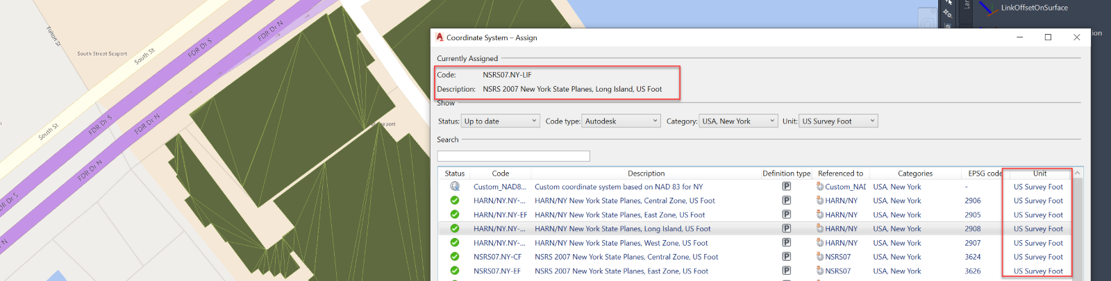
The preceding image of ArcGIS Pro shows the coordinate system assigned in Civil 3D using US Survey Foot units.
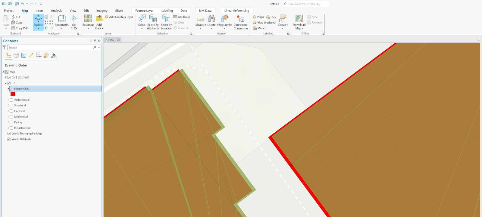
The image above shows the offset between a feature class exported from an IFC file versus the original Civil 3D feature class.
Cause
IFC files do not support US Survey foot units.
Solution or Workaround
The IFC file must be georeferenced to update its position, as described in the ArcGIS Pro help document: Georeference BIM data.
Article ID: 000027481
- ArcGIS Pro 2 x
Get support with AI
Resolve your issue quickly with the Esri Support AI Chatbot.


Related Information
Discover more on this topic
Search for related information
Find training related to this topic
Explore ideas and give feedback
Get help from ArcGIS experts
Start chatting now