
HOW TO
Convert a geodatabase feature class and annotation to a CAD file
Summary
Instructions provided describe how to convert a geodatabase feature class and annotation to a CAD file.
Procedure
ArcGIS Pro
- In ArcGIS Pro, click the Analysis tab, and click Tools in the Geoprocessing group.
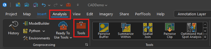
- Search for Export to CAD.
- In the Input Features section, select the features to convert, select an Output Type, such as .dwg, .dxf, or .dgn, and set the Output File name and location.
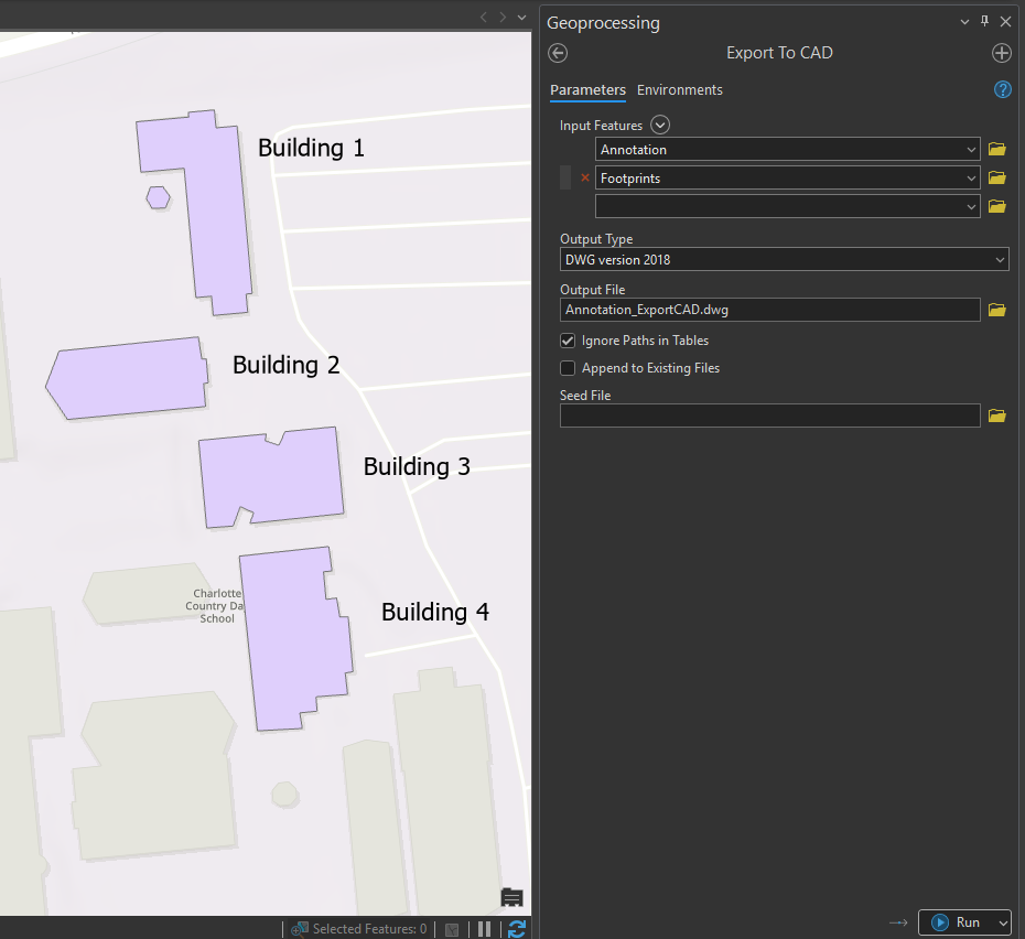
- Click Run.
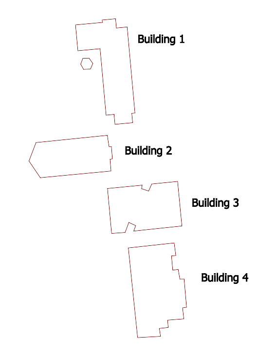
- Produces a .dwg, .dxf, or .dgn file of the selected feature classes and annotations from the map.
ArcMap
Note:
ArcMap has been retired as of March 1, 2026. There are no plans for future releases of ArcMap, and it is recommended that you migrate to ArcGIS Pro. Refer here for more information.
Follow the steps below to create geodatabase annotation and convert the geodatabase feature class and annotation to a CAD file in ArcMap.
- Start ArcMap.
- Add the geodatabase feature class to ArcMap.
- Right-click the layer in the table of contents and select Label Features to label the features.
- Convert the labels to annotation and store them in the geodatabase.
- Right-click the layer in the ArcMap table of contents.
- Select Convert Labels to Annotation.
- Select Store Annotation in a database.
- Specify the features for which annotation is created.
- Specify if the annotation is to be feature linked or not. If not, uncheck the Feature Linked check box, click the open folder icon, and specify the path and name of the new annotation feature class.
- Click OK.
- Click Convert.
- Convert the geodatabase feature class and Annotation feature class to a CAD file using the Export to CAD tool.
- Navigate to the ArcToolbox > Conversion Tools > To CAD toolset.
- Double-click Export to CAD.
- Select the feature class and annotation feature class as the input features.
- Select the CAD output type.
- Specify the output file location.
- Click OK.
Article ID: 000007092
Software:
- ArcMap
Get support with AI
Resolve your issue quickly with the Esri Support AI Chatbot.


Discover more on this topic

Search for related information

Find training related to this topic

Explore ideas and give feedback
Get help from ArcGIS experts
Start chatting now