HOW TO
Clip an Esri Basemap in ArcGIS Enterprise Portal Map Viewer
Summary
The steps provided describe how to clip the basemap in Map Viewer to an area of interest (AOI) boundary layer in Portal for ArcGIS.
Procedure
- Publish a vector layer (area of interest) as a web feature layer to an ArcGIS Enterprise portal.
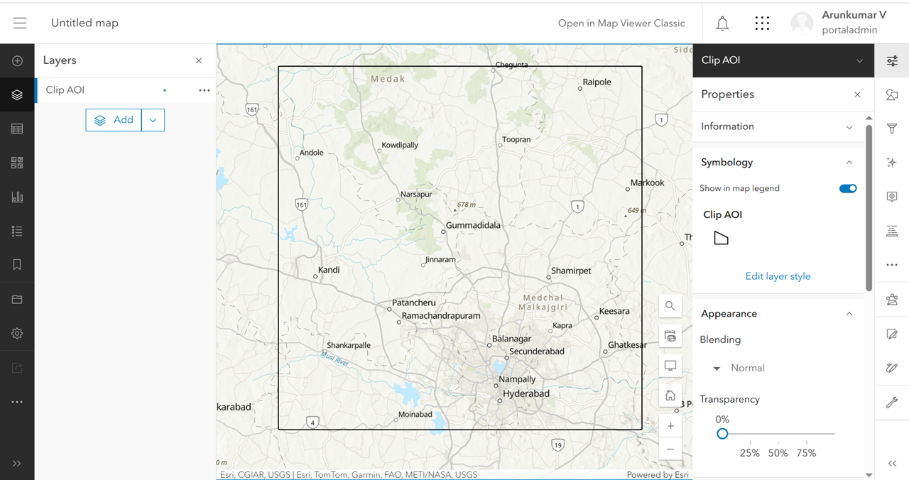
- Log in to the ArcGIS Enterprise portal and open the published web feature layer in Map Viewer.
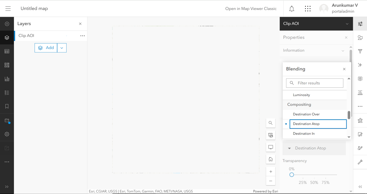
- Open the layer properties and in the Properties pane, choose the Destination Atop blending under the Appearance section, and close the blending pane.
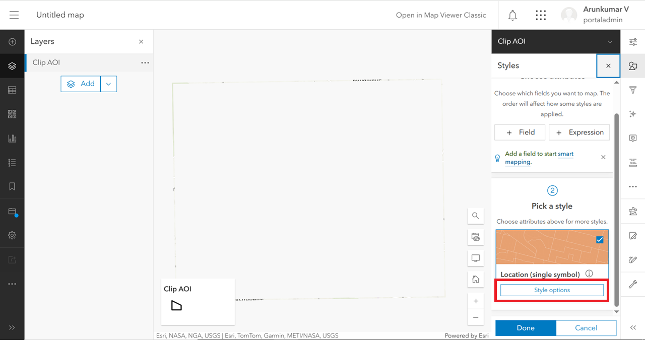
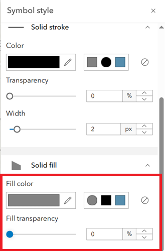
- Under Symbology, click Edit layer style.

- Click Style options.
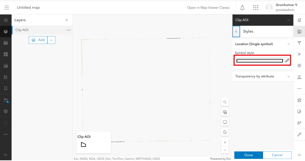
- Edit Symbol style.
- Under Solid fill, choose any fill color and set a Fill transparency value to 0, and click Done. Save it as a web map
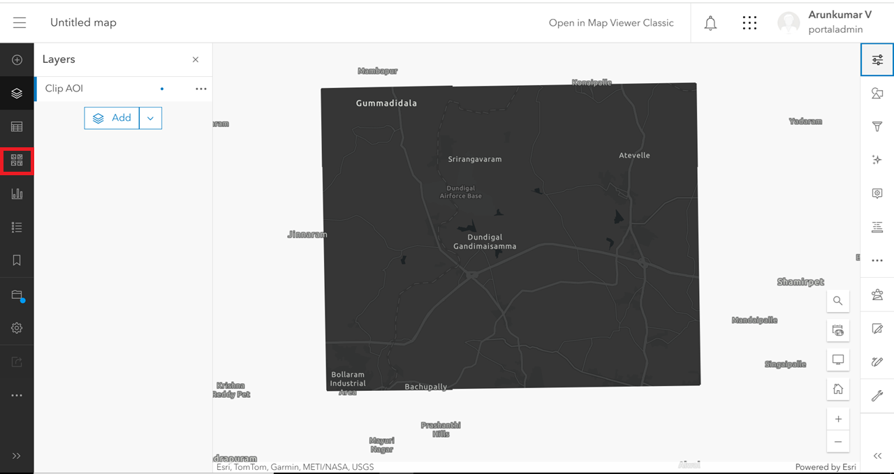
Note:
After clipping, some of the basemaps contain labels for the entire world extent (outside the AOI, as seen in the image below). This is because it contains a reference layer that includes reference labels for the entire world extent. To see the label only for the area of interest, reposition it by moving the layer from under the 'Reference' section to the 'Base' section.
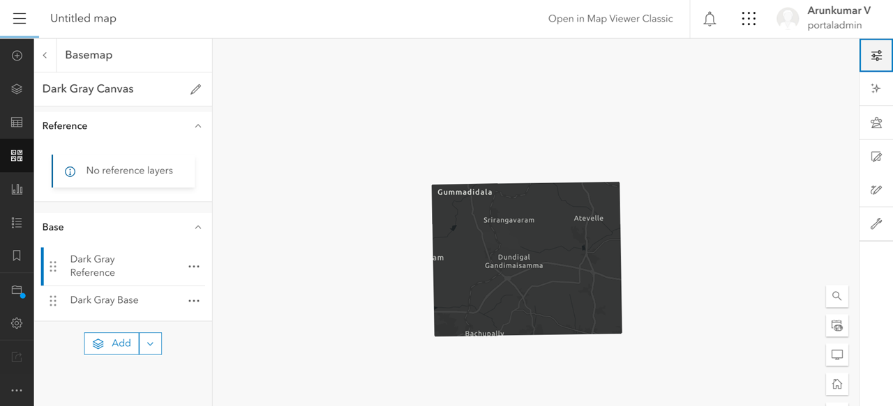
Steps to reposition the reference layer
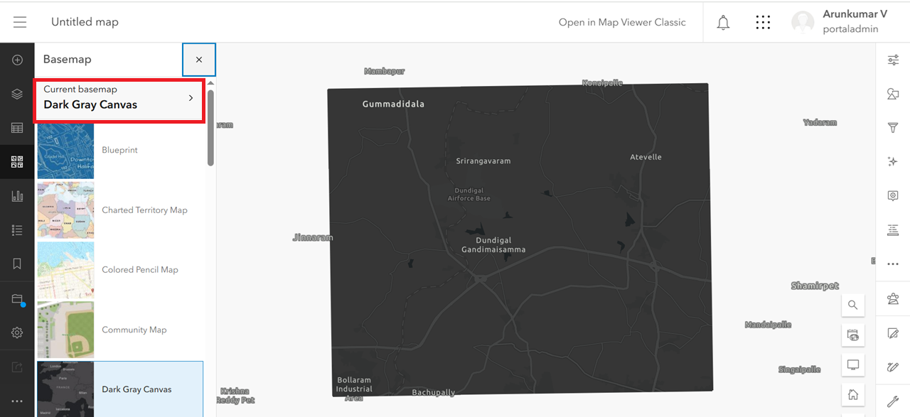
- Click the Basemap icon in the Contents toolbar.
- Click the Current basemap option.
- Move the layer located under the Reference section to the Base section by dragging it.
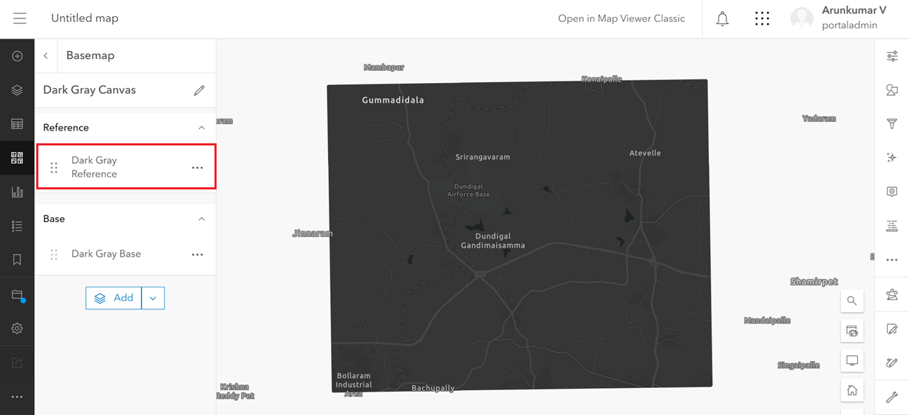
- After moving the layer from the Reference section to the Base section, the map appears as shown below. The basemap is now clipped for the area of interest.
Article ID: 000034818
Software:
- Portal for ArcGIS
Get support with AI
Resolve your issue quickly with the Esri Support AI Chatbot.


Related Information
Discover more on this topic
Search for related information
Find training related to this topic
Explore ideas and give feedback
Get help from ArcGIS experts
Start chatting now