HOW TO
Change the precision and scale during an export
Summary
In some cases, when importing data, the data type is changed and the precision and scale are not maintained. This is because data types behave differently between database management systems and ArcGIS software.
ArcGIS Desktop provides default values for precision and scale when using tool functions such as copy/paste and export. When transferring a table between geodatabases or databases, it is possible to change the precision and scale of the values in the table during the transfer.
Procedure
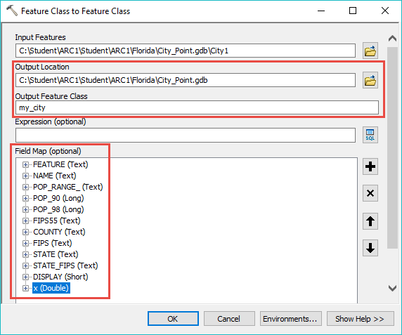
The following steps describe how to change precision and scale during an export:
- In ArcCatalog, right-click the desired feature class or shapefile.
- Navigate to Export > To Geodatabase.
- Fill in the Output Location and Output Feature Class name.
- In the Field Map, right-click the field name > Properties.
- Change the precision and/or scale.
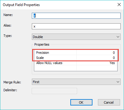
- Click OK and execute the export.
Article ID: 000018926
- ArcMap
Get support with AI
Resolve your issue quickly with the Esri Support AI Chatbot.


Related Information
Discover more on this topic
Search for related information
Find training related to this topic
Explore ideas and give feedback
Get help from ArcGIS experts
Start chatting now