BUG
ArcGIS Pro - Measuring geodesic distances doesn't work as expected in a local scene in Web Mercator while it works in a map.
Description
The Web Mercator projected coordinate system isn't appropriate for measuring planar distances and areas. If a map or a local scene uses Web Mercator, it would be necessary to measure distances and areas as geodesic and not planar.
Unfortunately, measuring the geodesic distance with the Measure tool in ArcGIS Pro does not work in a local scene which uses Web Mercator Auxiliary Sphere (EPSG: 3857).
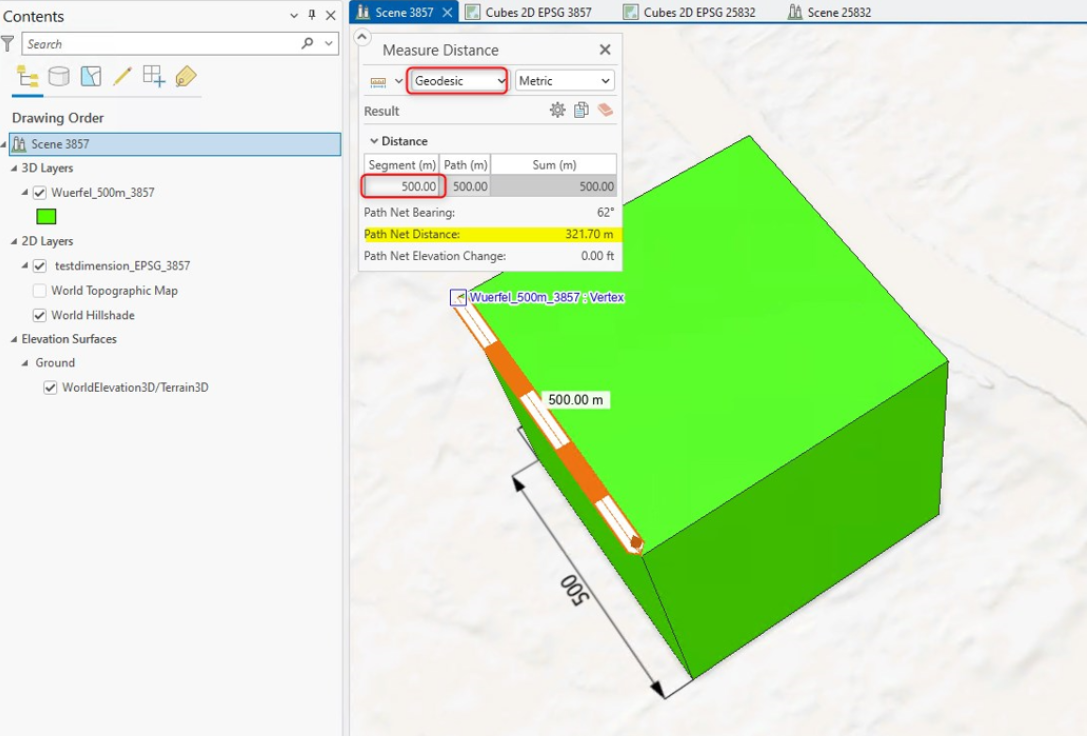
The screenshot below shows the measuring result for a 500m cube which was collected in Web Mercator. The geodesic distance should be significantly smaller than 500 m.
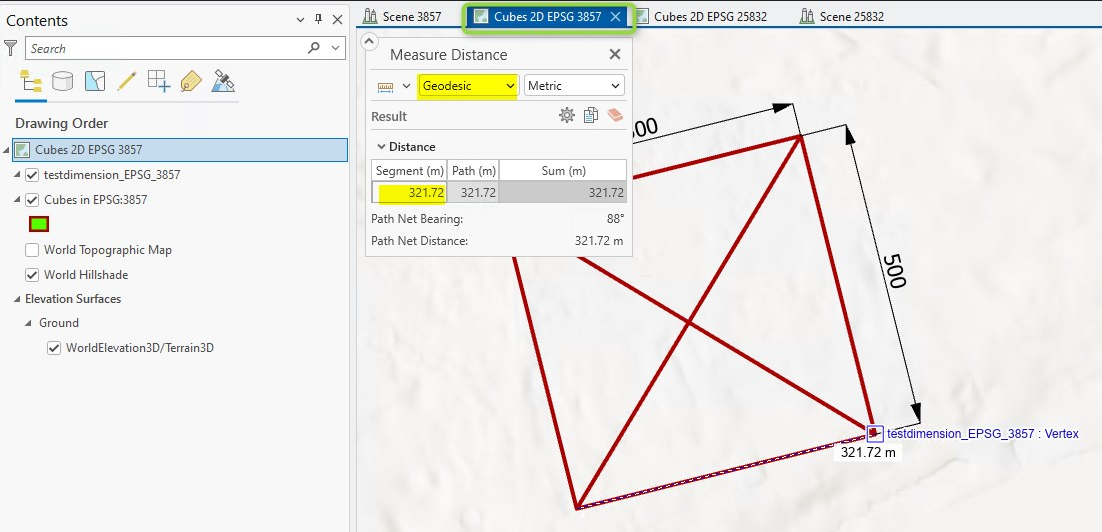
However measuring the geodesic distance in a map that uses Web Mercator does work as expected, as shown in the next image.
Cause
This is a known issue, BUG-000172263: ArcGIS Pro - Measuring geodesic distance does not work as expected in local scenes with Projected Coordinate System Web Mercator Auxiliary Sphere (EPSG code: 3857).
Workaround
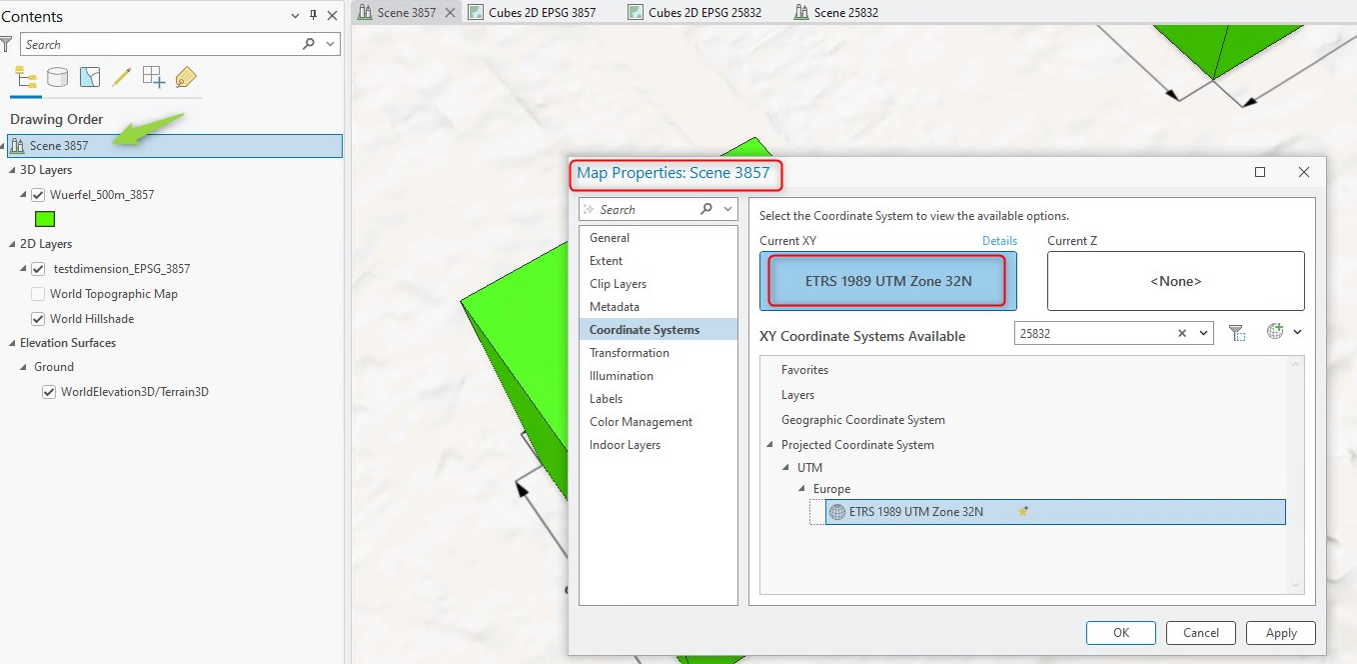
Change the coordinate system for the local scene from Web Mercator Auxiliary Sphere to a more appropriate projected coordinate system such as UTM, as shown in the image below.
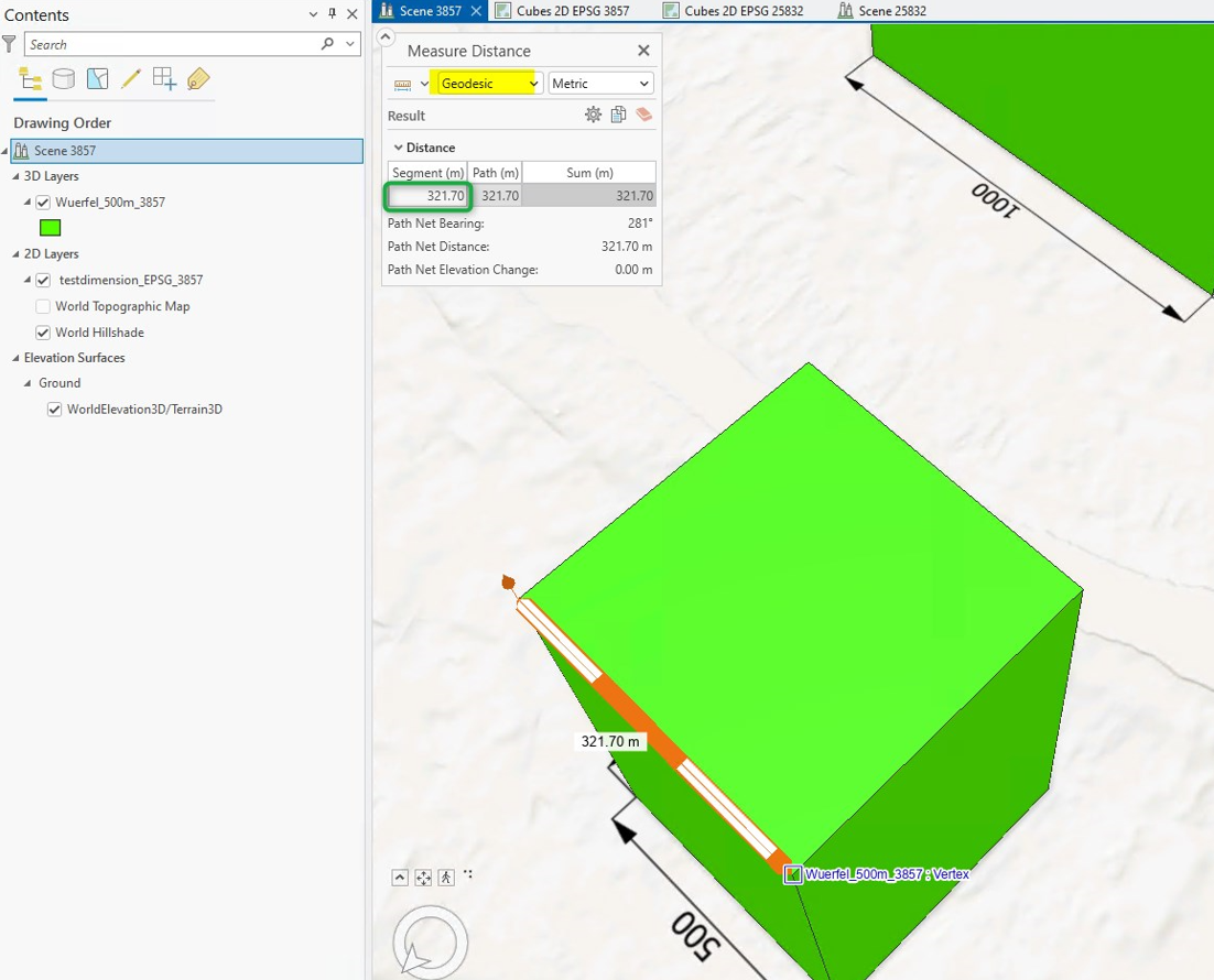
Measuring the geodesic distance should now work as expected.
Article ID: 000034189
- ArcGIS Pro
Get support with AI
Resolve your issue quickly with the Esri Support AI Chatbot.


Related Information
Discover more on this topic
Search for related information
Find training related to this topic
Explore ideas and give feedback
Get help from ArcGIS experts
Start chatting now