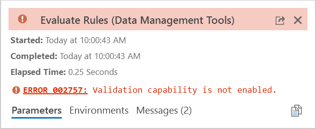
ERROR
002757: Validation capability is not enabled
Error Message
When running the Evaluate Rule (Data Management) tool to validate batch calculation attribute rules, the tool fails and returns the error message:
Error:
002757: Validation capability is not enabled
Cause
The Evaluate Rule tool allows us to assess either the batch calculation or validation attribute rules to a feature class or standalone table. But to achieve this, the following requirements must be met:
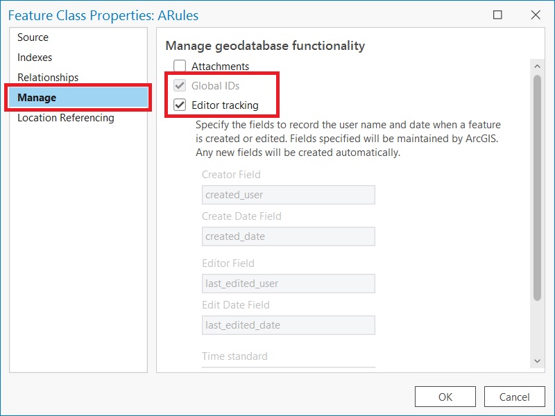
- The input (feature class or table) must have the Global ID enabled
- The editor tracking in the input must be enabled
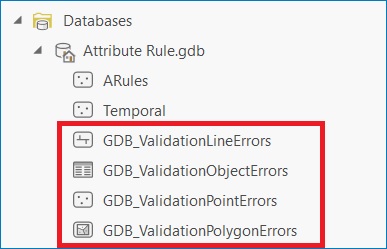
- The following error dataset for managing its validation. This is composed of four elements:
- GDB_ValidationLineErrors
- GDB_ValidationObjectErrors
- GDB_ValidationPointErrors
- GDB_ValidationPolygonErrors
Solution or Workaround
To enable both Global IDs and Editor tracking, right-click the layer from the Catalog pane > Properties > Manage tab, shown in the next image.
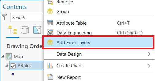
There are three scenarios to create the error layers:
- Normally, once the attribute rule is created, right-click the file geodatabase and click Refresh, the layers might be created automatically.
- If this is not the case, right-click the input in the Contents pane and click Add Error Layers.
- In a scenario where a preexisting layer with attribute rules is copied into a new file geodatabase, the error layers cannot be generated automatically or by using the Add Error Layers button. On this occasion, there are two workarounds:
Simply copy the error layers from an existing workspace and they will be used for evaluating the rules without issues. In case you cannot be provided by this dataset, proceed with option B.
Option B:
- Generate a temporary feature class within the same file geodatabase.
- Create an attribute rule to this layer.
- Refresh the file geodatabase and this automatically generates the error layers, as seen in the next image.
- The temporary feature class can be deleted.
Note:
Is not recommended to create the error dataset manually as standard feature classes/standalone table, this must be created using the appropriate methods. Otherwise, these layers may not be recognized to validate attribute rules.
Article ID: 000028646
- ArcGIS Pro
- ArcGIS Data Reviewer
Get support with AI
Resolve your issue quickly with the Esri Support AI Chatbot.


Related Information
Discover more on this topic
Search for related information
Find training related to this topic
Explore ideas and give feedback
Get help from ArcGIS experts
Start chatting now