A to Z GIS | Explore this related guide, featuring updated terms and graphics and developed in coordination with Esri’s GIS Dictionary team.
Learn more about A to Z GIS
GIS Dictionary
Browse dictionary
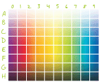
color map
URL copiedShare URL
[image processing]
A set of alphanumeric definitions associated with specific colors. Color maps are most commonly used to display a raster dataset consistently on many different platforms. Not to be confused with a color picker.