HOW TO
Planen eines Flugs in Site Scan Flight for ArcGIS ohne WLAN- oder Mobilfunknetzzugriff
Zusammenfassung
Instructions provided describe how to plan a flight in Site Scan Flight for ArcGIS without Wi-Fi or cellular network access.
Ursache
Vorgehensweise
Cases of flight plans in use
- Flying a site without access to Wi-Fi or a cellular network
- Planning a flight for others to fly at a different location
- Planning a flight in the office to be flown at a later date
- Ensuring data are collected the same way every time
- Saving a completed flight to fly again
Plan flights from the home screen
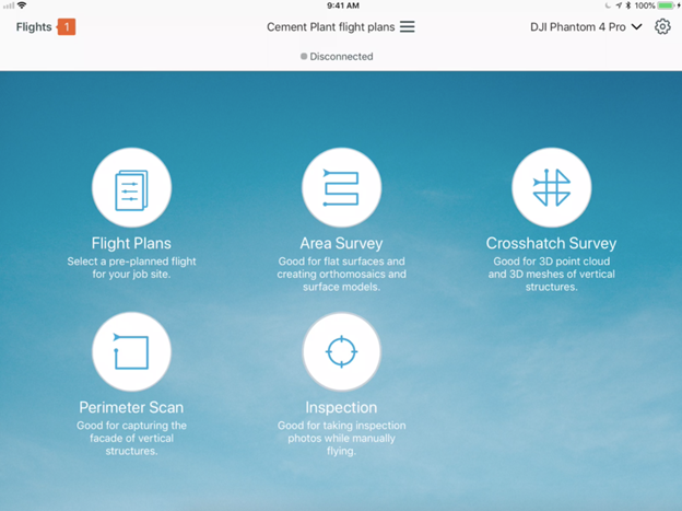
- From the Home screen, select Flight Plans.
- Select a flight mode.
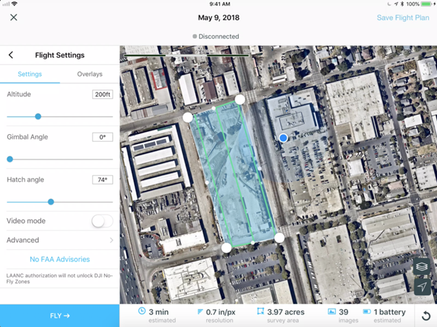
- Name the flight plan and select a location.
- Click Next and the flight plan is saved.
- Edit the polygon over the site, and adjust the map, flight path, and settings as needed.
- Click Save Flight Plan at the top-right corner.
After flying
After the vehicle lands, select Save as Flight Plan. This works for new flights and re-flying existing flights.
Note:
Re-fly can be accessed at the top of the Flight Plans menu tab.
Download maps in the Flight Plans menu for use offline. This saves the map at the location and zoom level on the screen, with the flight path.
Only the name of a flight plan can be edited without creating a new plan. This ensures data are consistent for future analysis.
Flight plans can be duplicated and renamed if the user wants the flight path to remain the same but the flight settings to be different.
Artikel-ID:000023044
Hilfe von ArcGIS-Expert*innen erhalten
Die Esri Support-App herunterladen
Zugehörige Informationen
Weitere Informationen zu diesem Thema erkunden
Search for related information
Find training related to this topic
Explore ideas and give feedback