HOW TO
Create enlarged outlines for polygons in ArcMap
Summary
It is often desirable to do customize symbology, such as creating expanded outlines, or outlines that are offset from the original polygon by a certain amount.
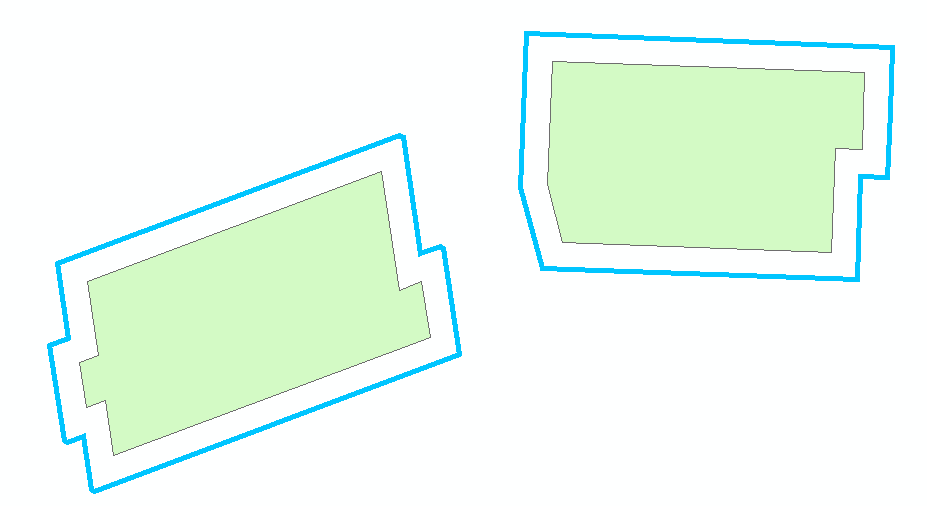
This article describes the steps to create offset outline symbology for a polygon, as shown in the image below.
Note:
This can only be done with a cartographic line symbols, which can be selected as the line type in the deeper symbology settings.
Procedure
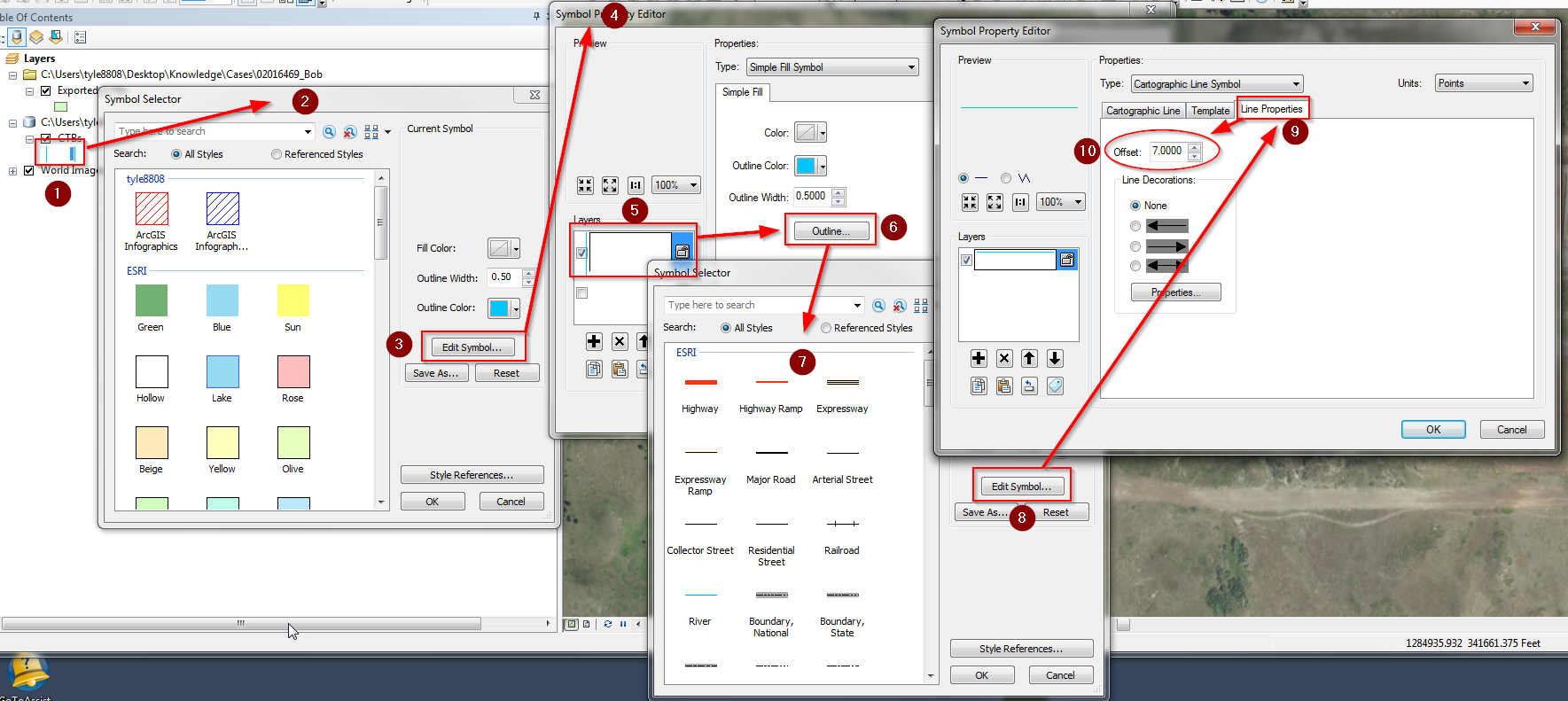
- Open Symbol Selector by clicking the symbol in the Table of Contents.
- Click Edit Symbol.
- Select the blue line 'layer' in the symbol property editor.
- Click Outline.
- Click Edit Symbol.
- Select Type: Cartographic Line Symbol
- Click the Line properties tab.
- Adjust the value for Offset here to adjust how 'enlarged' the outline symbology for the polygon appears, relative to the polygon itself.
Article ID: 000017114
Software:
- ArcMap
Get support with AI
Resolve your issue quickly with the Esri Support AI Chatbot.


Discover more on this topic
Search for related information
Find training related to this topic
Explore ideas and give feedback
Get help from ArcGIS experts
Start chatting now