HOW TO
Invert a surface using ArcGIS Spatial Analyst
Summary
Inverting a raster surface changes the highest cell values to the lowest and vice versa. The image below shows the original (before) and inverted (after) raster layer. Both layers use the same stretched symbology color ramp. The color difference between both raster layers show the change of the highest cell values to the lowest and vice versa.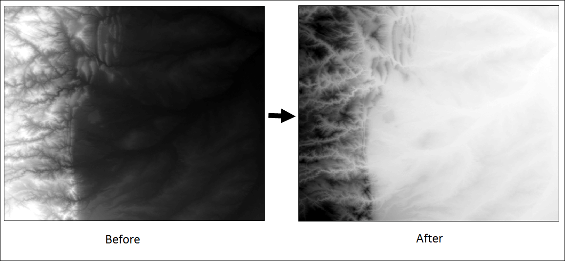
Procedure
The instructions below describe how to invert a raster surface.
- In ArcMap, add the raster layer.
- Right-click the raster layer in Table Of Contents and select Properties.
- Write down the Min (minimum) and Max (maximum) values found at the bottom of the Source tab.
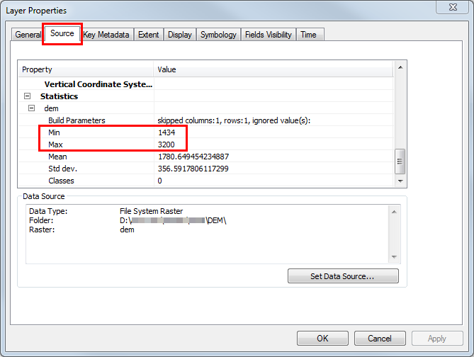
Note:
If the minimum, maximum, mean, and standard deviation values are blank, calculate the statistics for the raster layer before proceeding. In the Catalog pane, right-click the raster layer, and click Calculate Statistics.
- In ArcToolbox, navigate to Spatial Analyst Tools > Map Algebra > Raster Calculator.
- In the Raster Calculator dialog box, type the following expression in the expression box. Replace the RasterLayer, Max_value, and Min_value according to the raster layer.
(("Rasterlayer" - Max_value) * -1) + Min_value
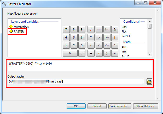
- Set the Output raster name and location.
- Click OK. A new inverted raster layer is displayed on the map.
Article ID: 000006694
- ArcMap
Get support with AI
Resolve your issue quickly with the Esri Support AI Chatbot.


Related Information
Discover more on this topic
Search for related information
Find training related to this topic
Explore ideas and give feedback
Get help from ArcGIS experts
Start chatting now