ERROR
Error 000401: No features were found for processing
Error Message
Attempts to convert a KML (Keyhole Markup Language) file to a layer using the KML To Layer conversion tool returns the error message:
Error:
Error 000401: No features were found for processing
![[O-Image]](https://webapps-cdn.esri.com/CDN/support-site/technical-articles-images/000012910/00N39000003LL24-0EM39000000wdo1.png)
Note:
If the KML file contains addresses, Google Earth translates these addresses into real features by way of geocoding. The KML To Layer tool does not read, geocode, and convert the addresses to features.
Cause
This issue occurs if a composite image file (PNG or JPEG files) is saved as a KML file from a web browser. For example, if the All Files option is selected from a web browser, and adding the .kml included in the file name.
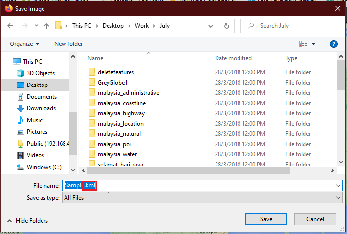
Image files do not contain any geometric features, even if the image is geo-registered; hence, the KML To Layer conversion tool experiences an error when detecting geometric features for processing.
Solution or Workaround
To ensure the image file is converted, check the option to Include Ground Overlay before proceeding with the conversion process. This enables the tool to convert all rasters or ground overlays to a raster catalog in the geodatabase. The source raster retains the native format and is found in the GroundOverlays folder located in the same location as the file geodatabase output folder. For more information on the KML To Layer tool, refer to ArcGIS Help - KML To Layer.
The following workarounds allow the user to bypass Error 000401:
In ArcMap:
Note:
The procedure is not possible in the web version of Google Earth.
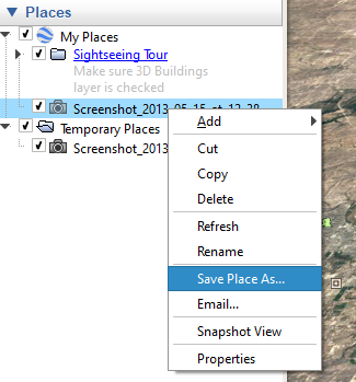
- Open the original image file in Google Earth Pro.
- Save the contents to a new KML file, right-click the file, and click Save Place As.
- Convert the new file to a layer using the KML To Layer conversion tool located in System Toolboxes > Conversion Tools > From KML > KML To Layer.
- Ensure that the Include Ground Overlay (optional) checkbox is checked.
![[O-Image]](https://webapps-cdn.esri.com/CDN/support-site/technical-articles-images/000012910/00N39000003LL2C-0EM39000000wdnv.png)
- Click OK.
- Re-create the KML through the ArcGIS Portal Directory, and ensure the button Vector layers as vectors and raster layers as images is selected.
Article ID: 000012910
- ArcMap
- ArcGIS Server
Get support with AI
Resolve your issue quickly with the Esri Support AI Chatbot.


Related Information
Discover more on this topic
Search for related information
Find training related to this topic
Explore ideas and give feedback
Get help from ArcGIS experts
Start chatting now