HOW TO
Create a slope map from contour lines in ArcMap
Summary
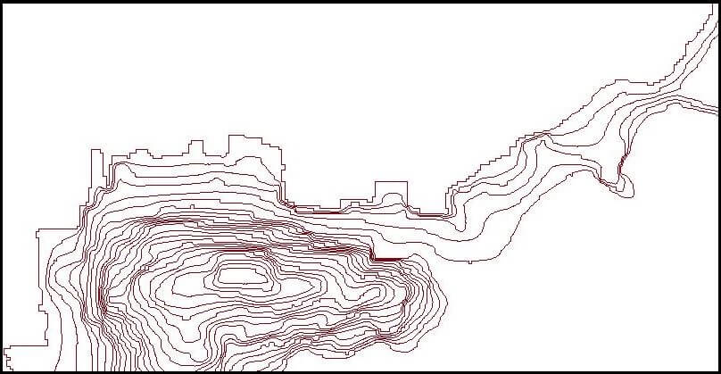
The Slope tool can be used to create a slope map by identifying the slope from each cell of a raster surface. Contour lines are usually presented as line features in a shapefile or feature class (vector data). However, a slope map cannot be created directly from contour lines because the Slope tool does not support vector data as the input.
The instructions provided describe how to create a slope map from contour lines.
Procedure
Note:
The Topo to Raster and Slope tool require a Spatial Analyst or 3D Analyst license.
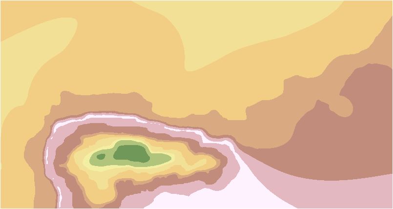
- Create a digital elevation model (DEM) from the contour layer.
- Navigate to System Toolboxes > Spatial Analyst Tools > Interpolation > Topo to Raster.
- Select the contour layer as the input feature data.
- Specify the location of the output surface raster.
- Set the output extent the same as the contour layer's extent.
- Click OK. A raster layer is created from the contour.
Note:
Refer to ArcMap: Topo to Raster for more information on the Topo to Raster tool, .
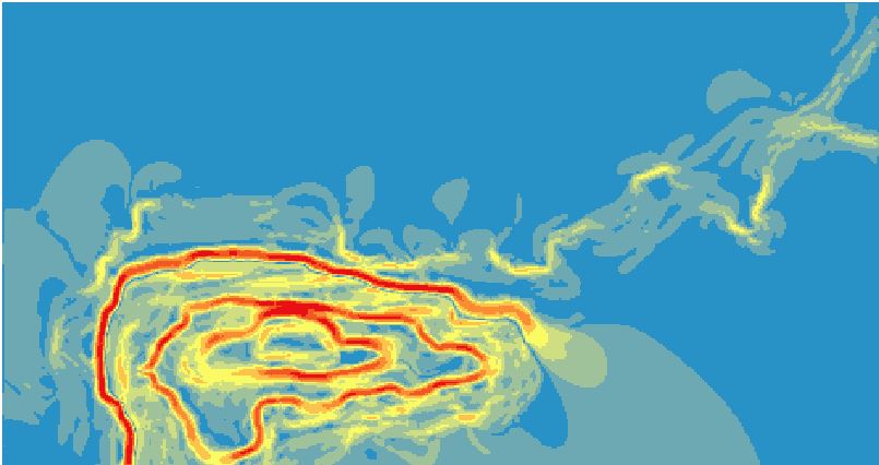
- Create a slope map from the DEM layer.
- Navigate to System Toolboxes > Spatial Analyst Tools > Surface > Slope.
- Select the output of the Topo to Raster tool as the input raster.
- Specify the location of the output raster.
- Select the output measurement.
- Click OK. A slope map is created from the DEM layer.
Note:
Refer to ArcMap: Slope for more information on the Slope tool.
Article ID:000012846
- ArcMap
Get help from ArcGIS experts
Download the Esri Support App
Related Information
Discover more on this topic
Search for related information
Find training related to this topic
Explore ideas and give feedback