HOW TO
Convert each pixel of a raster into a polygon
Summary
In ArcMap, the Raster To Polygon tool cannot be used to convert each cell of a raster into a polygon if the raster does not have unique values. The tool produces a polygon feature from a group of cells that have the same values, and not from each individual cell. This article describes the workflow to convert each pixel of a raster into a polygon.
Procedure
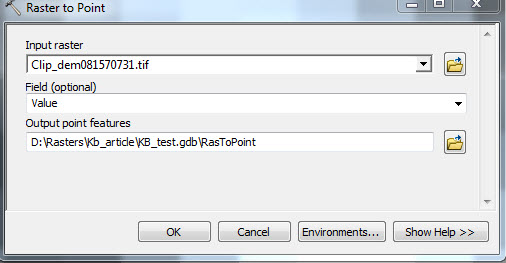
- Use the Raster to Point tool to convert each pixel to a point. Navigate to ArcToolbox > Conversion Tools > From Raster > Raster to Point. These points are later used to label polygons.
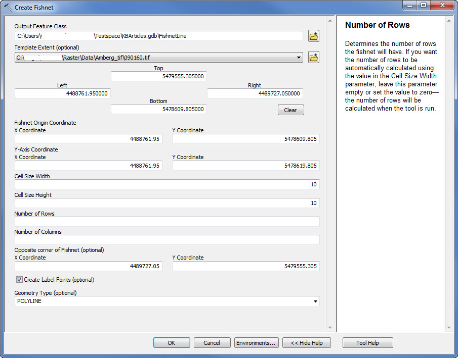
- Navigate to ArcToolbox > Data Management Tools > Sampling > Create Fishnet. The values entered into this tool are taken from the properties of the raster.
Note:
To access the properties of the raster, right-click the raster on the Table Of Contents in ArcMap, and click Properties > Source tab.
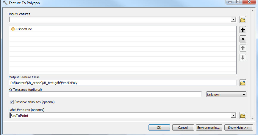
- Navigate to ArcToolbox > Data Management Tools > Features > Feature To Polygon. Run the Feature to Polygon tool on the fishnet output from step 2, with the Raster to Points output specified in the Label Features field. This gives the final polygon which has a field named GRID_CODE with the cell values of the raster.
The following image displays the raster pixels converted to polygons.
![[O-Image]](https://webapps-cdn.esri.com/CDN/support-site/technical-articles-images/000012696/00N39000003LL2C-0EM39000000wdiy.png)
Article ID:000012696
- ArcMap
Get help from ArcGIS experts
Download the Esri Support App
Related Information
Discover more on this topic
Search for related information
Find training related to this topic
Explore ideas and give feedback