HOW TO
Associate attributes of other features with a parcel
Summary
In an ordinary polygon layer, a newly updated feature class can be substituted for the original feature class. However, in the cases of parcel fabric polygons, a new polygon layer cannot be used to replace the original polygon parcel layer.
The instructions provided describe how to associate attributes of other features with a parcel to update the original parcel feature class with selected fields from the table being joined, all the while preserving the original parcel feature class.
Procedure
- Use the Spatial Join tool to join the parcel layer and the feature class layer based on the spatial relationship.
- In the Catalog window, navigate to System Toolboxes > Analysis toolbox > Overlay > Spatial Join.
- Set the feature class layer as the target feature.
- Set the parcel layer as the join feature.
- Specify the location and name of the output feature class.
- Select JOIN_ONE_TO_ONE as the join operation. This prevents multiple copies of any parcel records from being included in the output feature.
- Click OK. A new feature class with the fields from the parcel layer and feature class layer being joined is created.
- Join the desired attributes of the new feature class back to the original parcel layer. The Join Field tool allows the selection of certain fields to be included in the output feature. The Add Join tool generates all fields joined in the output feature.
- Option A: Use the Join Field tool
- In the Catalog window, navigate to Systems Toolboxes > Data Management toolbox > Joins > Join Field.
- Set the parcel layer as the input table.
- Use the field containing unique values for joining, such as the parcel number.
- Set the newly created feature class layer as the join table.
- Specify the output join field.
- Select the fields to be included in the joined table.
- Click OK.
- Option B: Use the Add Join tool
- In the Catalog window, navigate to Systems Toolboxes > Data Management toolbox > Joins > Add Join.
- Select the parcel layer as the layer name or table view.
- Use a field containing unique values for joining, such as the parcel number.
- Select the newly created feature class layer as the join table.
- Specify the output join field.
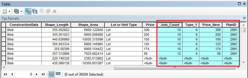
- Click OK. The original parcel feature class is updated with fields from the table being joined.
- Option A: Use the Join Field tool
Article ID:000001115
- ArcMap
Get help from ArcGIS experts
Download the Esri Support App
Related Information
Discover more on this topic
Search for related information
Find training related to this topic
Explore ideas and give feedback