PROBLEM
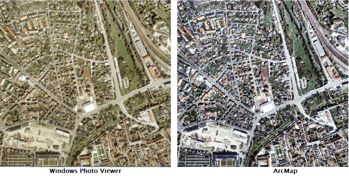
The color of a raster image in ArcMap does not match the original raster image
Description
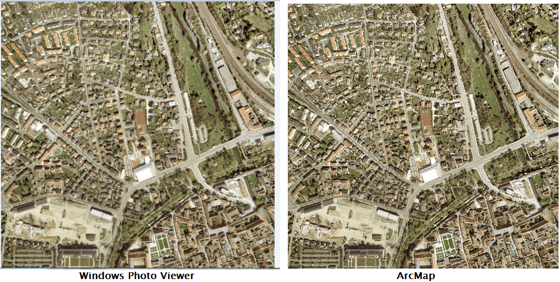
When adding a raster to ArcMap, the image color in ArcMap does not match the original raster image viewed through other programs like Windows Photo Viewer.
Cause
This is often due to the default stretch type symbology that is applied to the raster layer before displaying in the data frame. Stretch types display the image using the full color spectrum, even if the raster cell values are limited to a smaller range.
Solution or Workaround
There are three ways to do this:- Set the Stretch Type to None in the Layer Properties dialog box
- Set the Source Type to Processed in the Raster Dataset Properties dialog box
- Set the Stretch Type to None in the ArcMap Options dialog box
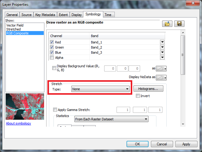
Layer Properties method
This option removes the stretch type for selected raster layers or datasets individually after being added to the map frame.- In the Table Of Contents, right-click the raster layer, and click Properties.
- In the Layer Properties dialog box, click the Symbology tab, and change the Stretch Type to None.
- Click Apply and OK.
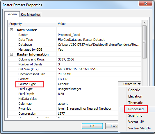
Raster Dataset Properties method
This option removes the stretch type from raster layers individually before being added to the map frame.- Remove the raster layer from the data frame.
- Right-click the raster dataset in the Catalog window, and click Properties.
- On the General tab, expand Raster Information, and change the Source Type to Processed.
- Click Apply and OK. ArcMap does not apply stretch on a raster dataset when the Source Type is set to processed. For more information on the Source Type property, refer to Raster rendering behavior.
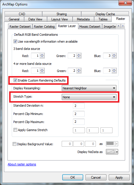
ArcMap Options method
This option removes the stretch type by default for all raster datasets before being added to the map frame.
- Click the Customize menu > ArcMap Options to open the ArcMap Options dialog.
- Under the Raster tab, click the Raster Layer tab.
- Check the Enable Custom Rendering Defaults check box.
- Click the drop-down list for Stretch Type, and select None.
- Click Apply and OK.
Article ID: 000015733
- ArcMap
Get support with AI
Resolve your issue quickly with the Esri Support AI Chatbot.


Related Information
Discover more on this topic
Search for related information
Find training related to this topic
Explore ideas and give feedback
Get help from ArcGIS experts
Start chatting now