vertical geodetic datum
-
[geodesy]
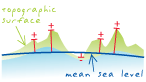
A geodetic datum for any extensive measurement system of heights on, above, or below the earth's surface. Traditionally, a vertical geodetic datum defines zero height as the mean sea level at a particular location or set of locations; other heights are measured relative to a level surface passing through this point. Examples include the North American Vertical Datum of 1988; the Ordnance Datum Newlyn (used in Great Britain); and the Australian Height Datum.