A to Z GIS | Explore this related guide, featuring updated terms and graphics and developed in coordination with Esri’s GIS Dictionary team.
Learn more about A to Z GIS
GIS Dictionary
Browse dictionary
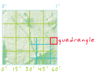
quadrangle
URL copiedShare URL
[map design, standards]
A rectangular map bounded by increments of latitude and longitude (quadrilaterals). Often a map sheet in either the 7.5-minute or 15-minute series published by the U.S. Geological Survey. Often known as topo sheet or shortened to quad. Each map in the series is usually named after a local physiographic feature in the mapped series, such as the Ranger Creek, Texas, quad map.